

Important note concerning Mining & Dredging Seasons on this Property
Google Earth Coordinates: 41 49’14.6″N 123 18’8.1″W
To view the content from the link above you will need to have Google Earth installed on your home computer. Download Google Earth
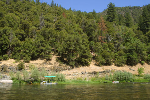
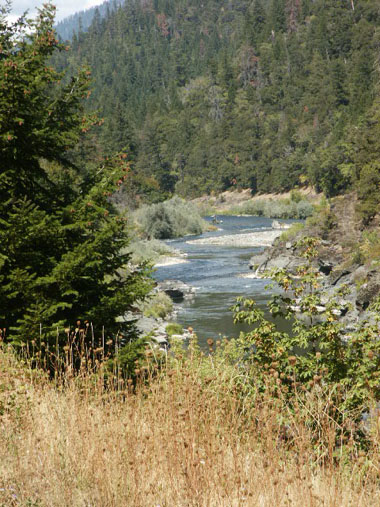
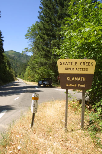
K-17 SEATTLE CREEK CANYON CLAIM – The downriver boundary (mile marker 49.12) is located 7.3 miles upriver on Highway 96 from Davis Road in Happy Camp. A sign is posted on a tree alongside the road. The upper boundary (mile marker 51.00) is located 2 miles further upriver, near the confluence of Seattle Creek. There is a developed river access (mile marker 51.00) at Seattle Creek, where we have a small campground. The Forest Service asks that we do not block the river access in any way, since it is a popular put-in and take-out location for other river users.
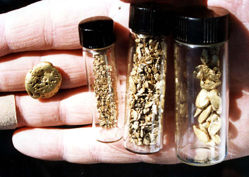
PROSPECTS: This is a very proven gold-rich section of the Klamath River, with hundreds of ounces of gold having been recovered by Club members during the past several years. Much of this section of the river has yet to be tested. Some of it is pretty deep, both in water and gravel. There is excellent gold panning, mossing and surface mining on both banks of the river. The far bank has barely been touched by modern mining activity because access requires a boat. Trails and paths have been made from Highway-96 to the river in multiple locations along the 2-mile stretch of claims. Some members have transitioned from prospecting to commercial status as a result of the gold they recovered from these claims. Prospects for new discoveries are very good.


Upper Klamath :: Upper-mid Klamath :: Mid Klamath :: Lower Klamath
Elk Creek :: Indian Creek :: Scott River :: Thompson Creek
Salmon River Main Stem :: Salmon River North Fork
Master List of Mining Properties


