

Google Earth Coordinates:
Parcel #1: 33°37’0.69″N 114°19’1.10″W
Parcel #2: 33°37’48.41″N 114°17’29.12″W
To view the content from the link above you will need to have Google Earth installed on your home computer. Download Google Earth
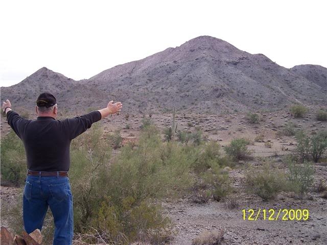
The Club’s property in Arizona consists of two separate half-mile square parcels which are relatively close to each other, several miles to the west of Quartzsite.
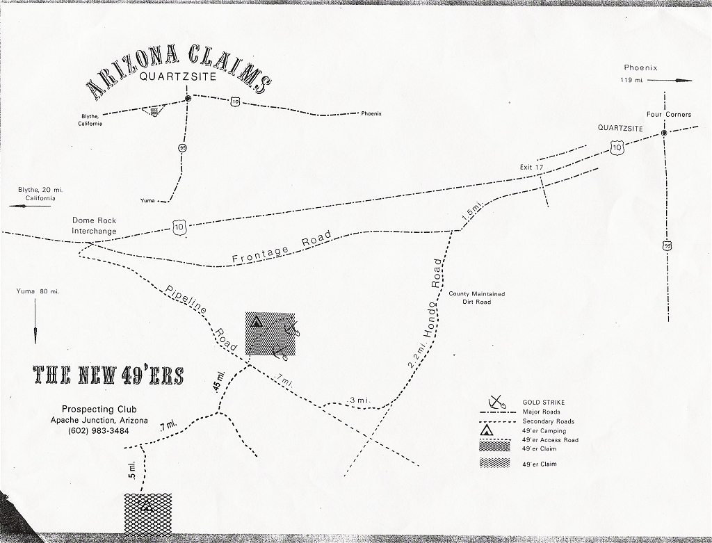
Original Map
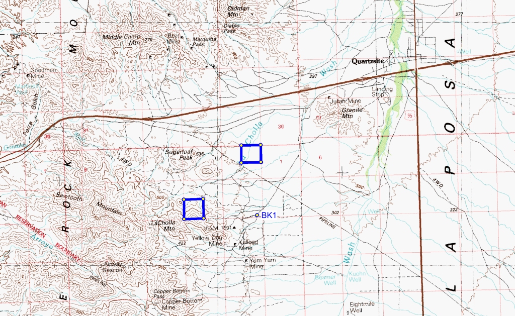
Newer Map
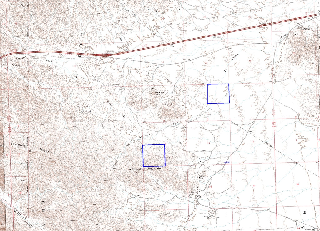
Closer View
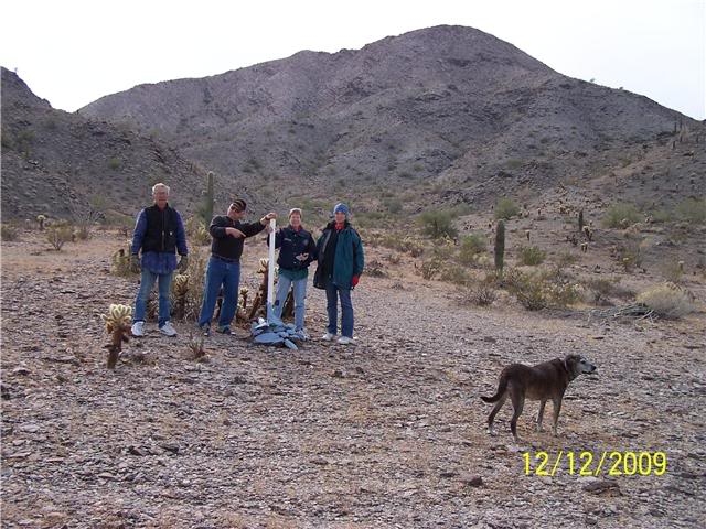
Here follows an explanation from Lee Kracher, one of the Club’s long-standing highly-supportive members who resides in Quartzsite during the winter months. Terry McClure, Mike & Sybil Thayer and Anita Kracher were also very helpful in providing the following information and images:
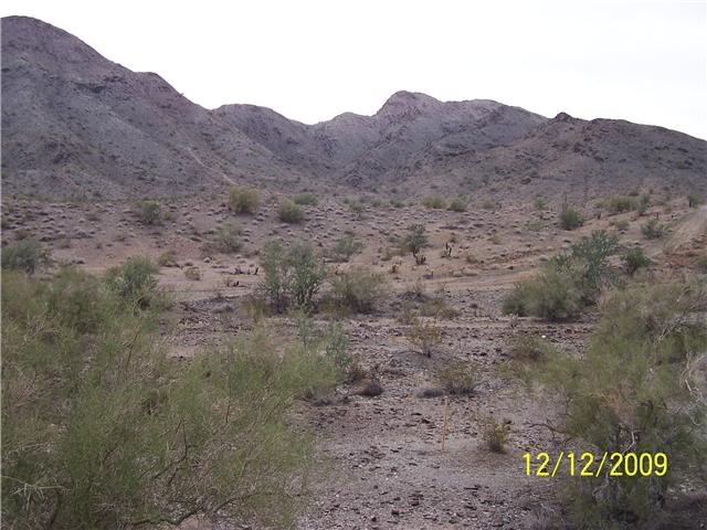
There are very few signs of serious work on either of the two parcels. We had really hard rains lately and most evidence of any workings has been washed away. But it really looks good out there!
I have talked with people who have worked all around the two claims, and they are finding gold. I gather that the gold is spotty and hasn’t moved very much.
For the most part, members should not expect to recover very much, because it is all hand work and limited yardage. It’s not like dredging. A cubic yard per day is a real big day’s work for one person out in the desert!
Desert mining (dry mining) is completely different than most people understand; and because of that, some members won’t have very much success.
Specialized gold metal detectors are the general rule of thumb down here. People who are finding the most gold nuggets at the moment are using the Minelab 3 and 4K Series and the Fisher Gold Bugs.
As for the others, even a blind dog finds a bone now and then. This is desert mining, so members should bring plenty of drinking water no matter what time of year.
Snakes can be a problem during the warm weather months, so those using metal detectors should be very watchful when outside noise is being blocked by head phones
A cell phone is considered a must-have for desert prospecting gear. Cell phone reception is great on both claims.
Directions: (see maps) From exit #17 on Interstate10, exit and go south to Dome Rock Road (look for the stop sign at the bottom of the over pass before the LOVE station). Make a right turn (west) there and go 1.4 miles where you should take a left on Cholla Street. Then go 2.4 miles (until the pavement makes a 90 degree left turn), where you will take a right on a well-traveled gravel road (Pipeline Road has no sign at the moment). At about 9/10ths of a mile, you will see a large rock on the right with “49ers” painted in white. Take that gravel road about 30 yards and you will find a 4″ PVC pipe with a red top. This is the SW corner of parcel #2.
Because conditions change from occasional flooding, I strongly suggest you drive into these sites and take a look, before pulling an RV to these properties.
Camping: The BLM does not allow camping in this part of the desert; it is designated as day-use only. There are campgrounds both private and BLM (improved) within a reasonable distance, where you can camp year around for a nominal fee.
There is excellent quadding in the whole area. So even if you are camping some distance away, you can get to these claims within several minutes.
You can also boon-dock (2 week maximum stay on the public lands) just north of our properties on the BLM land between Dome Rock road and the northern boundary of parcel #2.
Also, there is a park at the corner of Cholla and Dome rock, about 3 miles away. They are usually full-up for complete hook ups, but I believe they have some dry spots which have electricity. You would still have to haul your black and grey water (they have a place to dump) even if you are boon-docking. They also have water available. This is a great area for off-road quadding.
For your supplies, its only about 5 miles into Quartzsite or about 20 miles to Blythe (California).
Parcel #1: (160 acres)
Directions: (see maps) 2WD from the pipeline road. Look for the rock with “49ers” painted on it. This is a gravel road going west. Go 1 mile and turn left at the fork (you will see a “49’er” sign in blue rocks). If you watch, in about 1/10th of a mile, there is a faint trail going off to the left. Do not continue on straight unless you have 4 wheel drive or a quad. This road will dead-end at a 49’er marker. This is located at about the middle of the north boundary of Parcel #1.
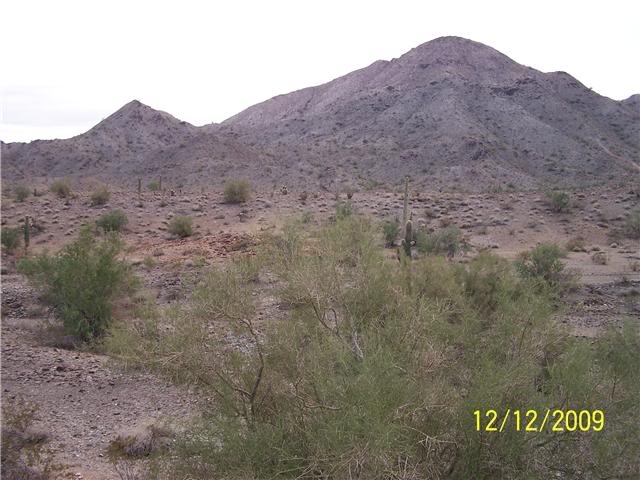
This property should have some good gold from erosion and lack of mobilization of material. The canyon in there looks to me to have the best prospects. There appear to be many, many lucrative areas to be worked.
You can get to parcel #1 with 2-wheel drive, but it will take 4wd or quad to venture further out onto the property. This is because there are big washouts in the arroyo. On the sloped/flatter areas, bedrock appears to be around 3 to 6 or 7-feet deep. It looks to me like there should be some good workings on it.
When you go to parcel #1, don’t go too fast down the road. When I say “don’t go beyond,” I mean don’t ! It’s 4 wheel or quad. At the end of the trail to the middle of the northern boundary, you can continue on with a quad. I wouldn’t even go that far with a 4wd, because it gets narrow, slanted and bushy. Even a dune-buggy may have a hard time going up that far. It leads to a very nice canyon in the SW quadrant. You might want to hike up there first to have a look.
More GPS readings: NE corner marker is at 33°37’1.60″N 114°18’48.17″W, and the NW corner marker is at 33°36’59.28″N 114°19’14.95″W.
Parcel #2: (160 acres) The GPS coordinate above will take you to the claim at the southwest corner.
My perception is that this will be a deep claim, because it is a delta fan-type alluvial deposit. You can access nearly all areas of Parcel #2 with a 2-wheel drive.
We can see a few places where some dry washing has been done. This claim is sort of a “delta” fan and is in the drainage of some well-known lode mines. From what I have heard, and my own very limited experiences here in the desert, gold will be found from the surface on down to the cliche (like a hardened clay) and beyond. Some local prospectors have used air chisels to break up the hard pack and recovered good gold out of it, and also out of the overburden.
This is desert mining and in no way is it similar to working areas where movement was water-powered. Here, gold is where you find it, and doesn’t seem to have or follow a common path like it does in river mining.
The gold in this area is mostly fine, but I know of one quarter-ounce nugget found lying on the top of the ground in plain sight, and my neighbor has a hand-full of small nuggets that he has metal detected right above (west) of this claim. There is a guy who has been working a hole in the same spot for 7 years, to the south of this claim. He says that he keeps finding pockets of gold up to 8 ounces.

Upper Klamath :: Upper-mid Klamath :: Mid Klamath :: Lower Klamath
Elk Creek :: Indian Creek :: Scott River :: Thompson Creek
Salmon River Main Stem :: Salmon River North Fork
Master List of Mining Properties


