


FOURTH QUARTER, DECEMBER 2011 VOLUME 25, NUMBER 11
 By Mark Chestnut
Note: Oregon Now Has Placed a Moratorium on Motorized Prospecting!
I had been hearing good things all during this last dredging season from other New 49’er members about the South Umpqua River in Southern Oregon. So my wife, Terri and I were already planning a trip up there to have a look around. When Dave Mack asked if we would go up there to do a (very) thorough survey on behalf of The New 49’ers, we immediately postponed all our other plans and jumped at the chance to check out this whole new mining opportunity. I’m really glad we did!
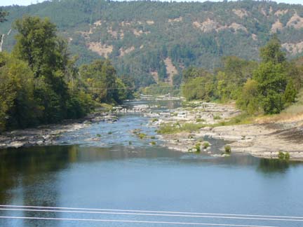
The section of South Umpqua we focused our attention on is located between Tiller and Roseburg Oregon. This area is located in and south of the city of Roseburg, which is 123 miles north of the California border on Interstate 5 and about 80 miles inland from the Oregon coast.
We specifically surveyed the dredging opportunities in this area because our preliminary historical research verified that Coffee, Cow, and Myrtle Creeks were all very gold-rich feeder streams into the South Umpqua. Back in the 1800’s, there were places on Coffee Creek that yielded up to two pennyweight of gold per pan, and Coffee Creek also boasts a nugget weighting six ounces found also in the 1800’s. Discussions I had with other members this past summer, and also locals in the area, more-than-confirmed that this is a productive stretch of river for modern gold prospecting. One local lady told us about how she and her father had spent a large part of her childhood sniping cracks in the exposed bedrock all over the South Umpqua from Canyonville to Roseburg, always finding some quantity of gold!
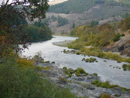
The South Umpqua is a smaller-sized river than where we have been dredging along the Rogue River these past two seasons. While the Rogue is generally fast, wide and cold; the Umpqua is generally narrower, slower and warmer. Since even Dave and I were being substantially challenged by the Rogue this past season, it was Dave Mack’s idea to turn up a bunch of new productive dredging opportunity for beginning and intermediate-experienced members that was not so difficult. And I have to tell you that after spending quite a lot of time looking over the opportunities (Terri and I made four different survey trips up there this fall), we have decided that even we will give the South Umpqua a try this next season! Dave Mack says he is going to go up there, too.
The first thing that hit Terri and I when we got up there is how beautiful it is. South Umpqua territory is the Pacific Northwest great outdoors in its best form! The area is marketed by the Roseburg Visitors Center as the “Land of Umpqua”. We highly recommend visiting their website so you can see just how many great opportunities this area provides to enhance your summer prospecting trip.
We found friendly, hospitable people everywhere we went. From farmers markets and u-pick gardens, to wineries, waterfalls and even an African Safari Park located in Winston. There are miles of bike paths and over 50 places to fish within 60 minutes of Roseburg.
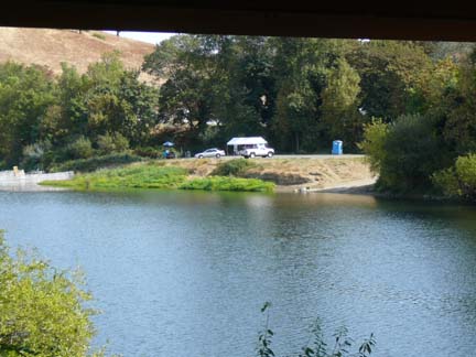
Access to the river is pretty good, with at least one public access point on each of the stretches of the river we established as open to members for suction dredging, hand sluicing and gold panning. Over half have 4 wheel drive access to the water’s edge and five stretches even have paved boat ramps!
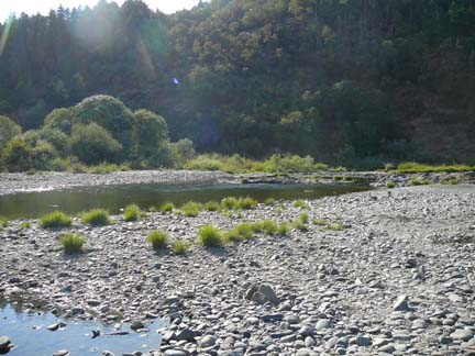
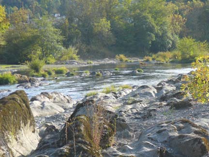
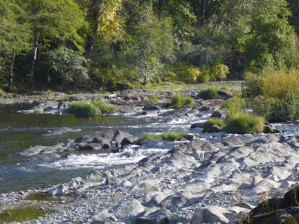
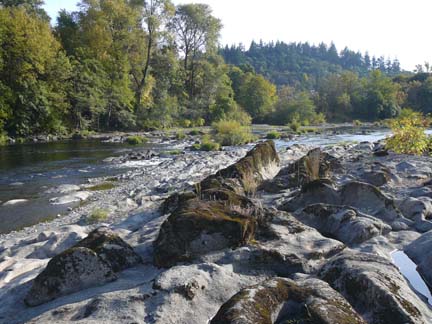
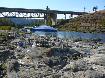
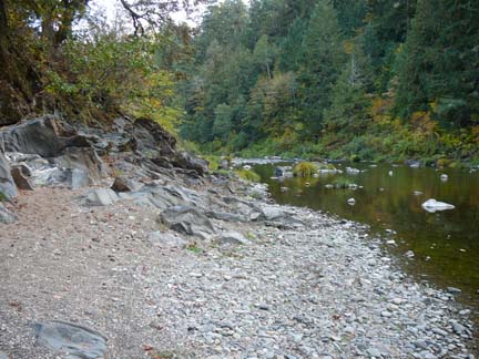
I was amazed to see how much bedrock was showing in and alongside the river. Locals told Terri and I that streambed depths are relatively shallow in most places, and that some prospectors just swim around and snipe gold from cracks in the exposed bedrock. There is plenty of slow, shallow water. This is going to be a wonderful area for beginners to get started! There are some great-looking areas for digging out cracks in the bedrock alongside the river!
We are also hearing stories of more experienced dredgers who have been mining high-grade deposits along the South Umpqua! One miner stopped in the Club’s office in Happy Camp this last summer and showed Montine some beautiful nuggets he had dredged from the South Umpqua. One other New 49er member wrote and said he had seen a lot of people panning, sluicing and dredging on the South Umpqua this last season when he drove through the area.
As the land ownership status along the Umpqua is a bit complex, Terri and I found ourselves devoting quite a lot of time in the Douglas County courthouse, the Tax Assessor, County Recorder, City of Roseburg, City of Myrtle Creek, Douglas County Parks Department, and the Oregon Department Of Transportation offices trying to figure it all out. We were pleased to receive a warm and helpful reception from all of the officials that we talked to.


My impression is that the entire area surrounding the South Umpqua is miner and dredging-friendly. There is a long history of gold mining in these parts. Quite a few of the locals we spoke with said they were also interested in getting more into mining because of the increased value of gold! As a matter of fact, the Director of the Douglas County Parks Department sat and talked with us for over an hour about his personal and family interest in gold panning and his desire to try gold dredging!


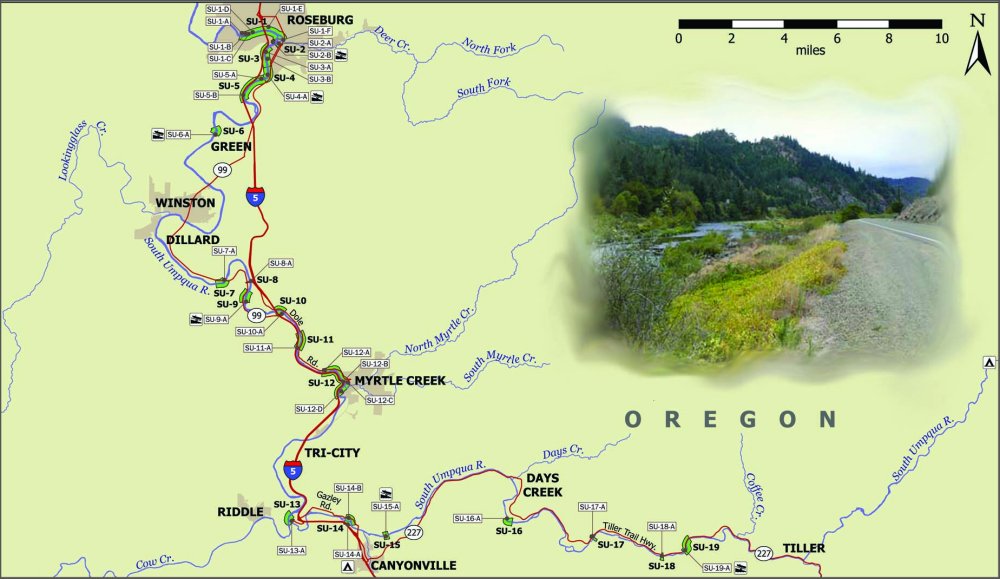
So, after doing considerable research, for the purpose of just getting a safe start for The New 49’ers, Terri and I decided to locate each stretch of South Umpqua that are considered by all authorities to be flowing across Oregon State Land. In all, we turned up 19 separate stretches of river, providing access to a combined total of just over ten miles of river within approximately 40 miles of the South Umpqua. Each of these available areas, along with the public access points, is listed on the map. They are identified using “SU” symbols.
Here is an expanded version of the map.
Particulars on each available area, along with each access point, are now outlined in our “South Umpqua Access Guide.” Terri and I have worked very hard to finish this. This guide will include GPS coordinates so members can get up on Google Earth and have a look from the sky!
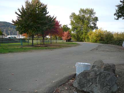
The towns along this stretch of the South Umpqua include Tiller, Days creek, Canyonville, Tri-City, Myrtle Creek, Dillard, Winston and Green. Roseburg is a rather large place with everything you will need to support your prospecting adventures. Canyonville and Myrtle Creek also have a good selection of stores.
Here are the details of the local prospecting store in Myrtle Creek: Rock’N Ore Prospecting, 304 N Main Street: (541) 863-6111. Or, from Canyonville, it is only 43 miles south to Armadillo Mining Shop, located at 2041 NW Vine St. in Grants Pass: (541) 476-6316.
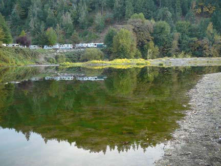
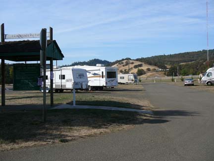
During our extensive surveys of the area, Terri and I made note of all the camping and lodging options that we ran across. These are outlined in our “South Umpqua Lodging Guide.” Most of the RV parks are located right on the river, are dredger-friendly and allow dredging right at the park as long as you are a paying guest!
In closing, I want to thank The New 49’ers for sending Terri and I to do these South Umpqua surveys. The area turned out to be much more than we anticipated! Now all we have to do is go up there and locate some high-grade in the river and we will be on top of the world! Terri and I plan on spending the last two weeks of June on the Rogue River this coming season, and then head over up to the South Umpqua when it opens on July 1st. We look forward to crossing paths with members out there this next season!
The New 49’ers Prospecting Association, 27 Davis Road, Happy Camp, California 96039 (530) 493-2012 www.goldgold.com


