Important note concerning Mining & Dredging Seasons on this Property

Google Earth Coordinates: 41 49’5.1″N 123 7’51.1″W

To view the content from the link above you will need to have Google Earth installed on your home computer. Download Google Earth


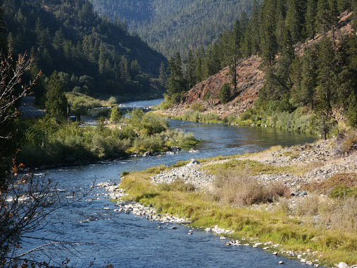
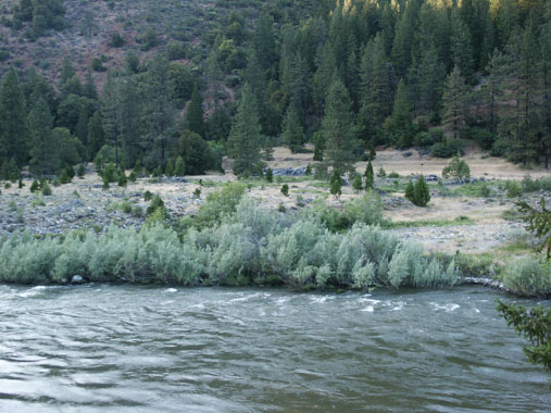
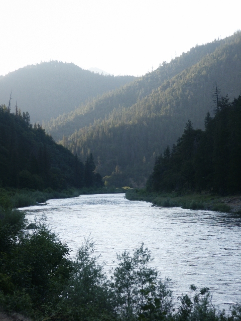
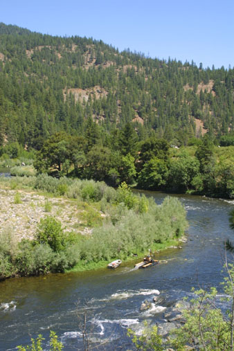
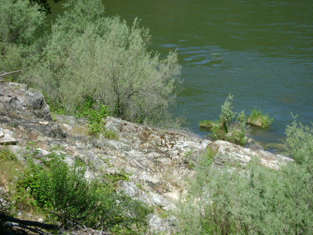
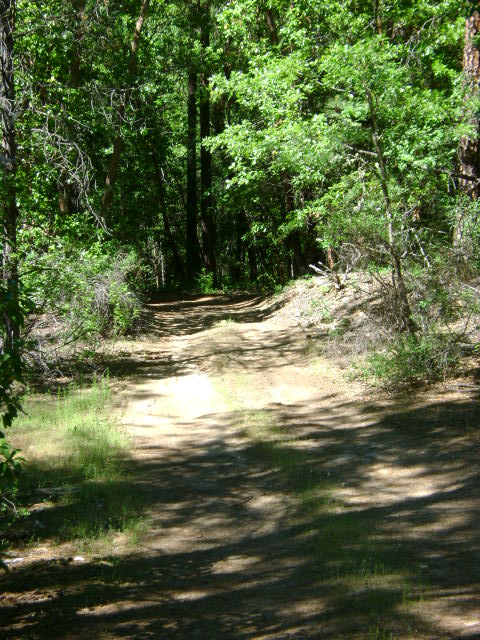
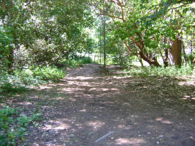
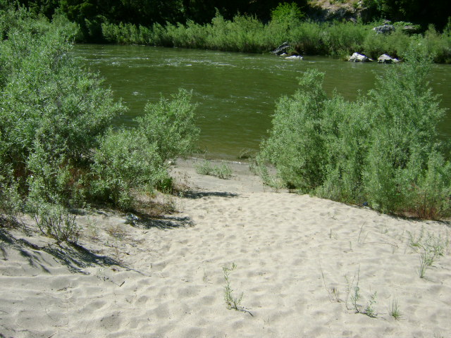
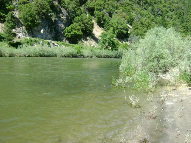
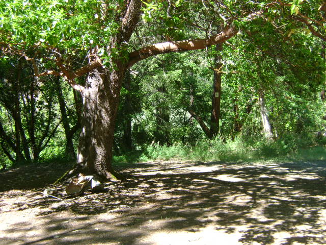
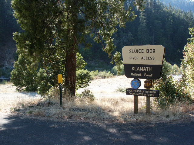
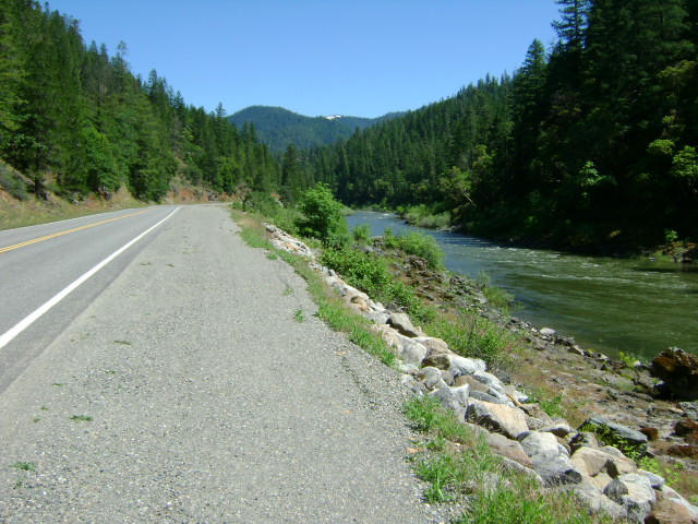
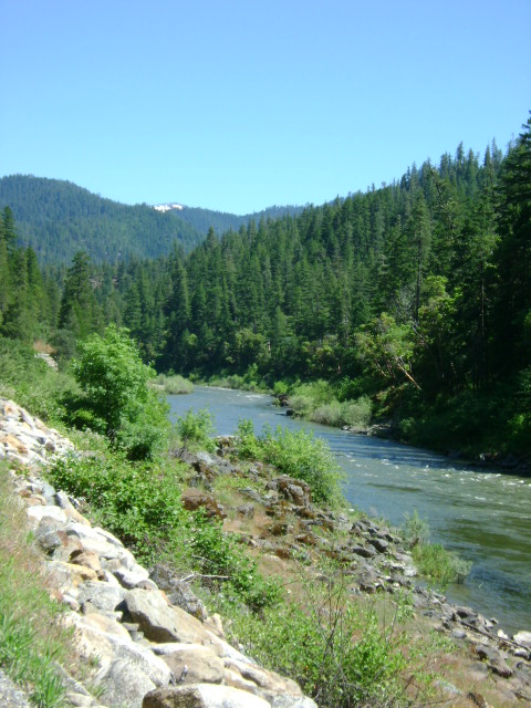
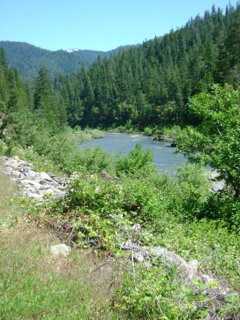
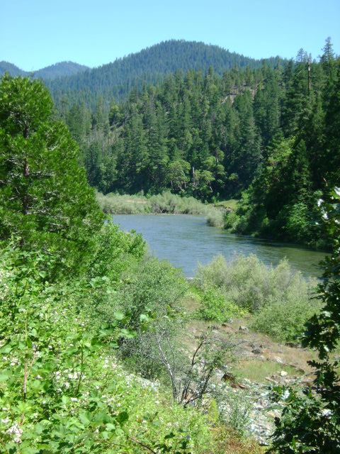
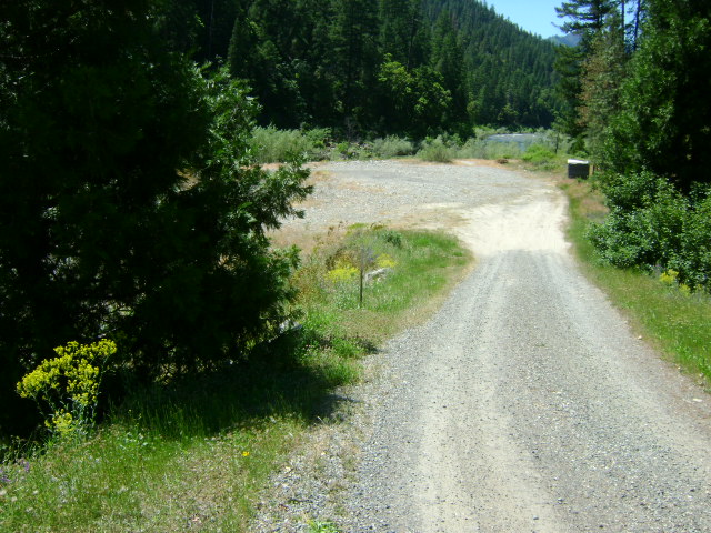
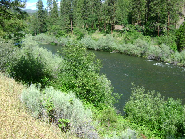
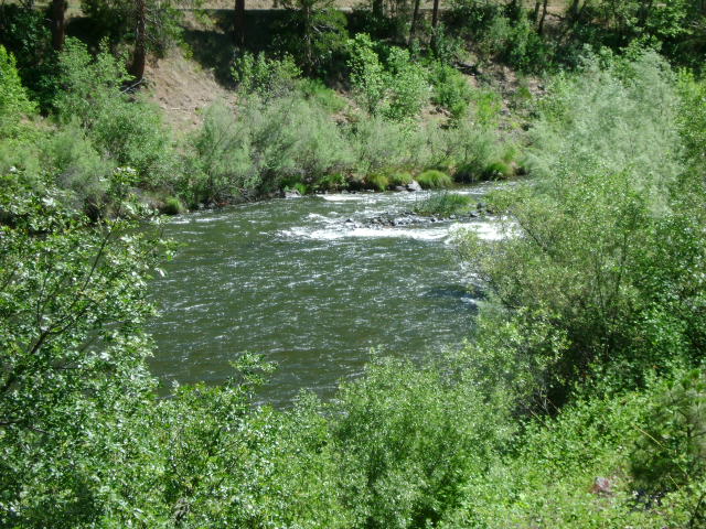
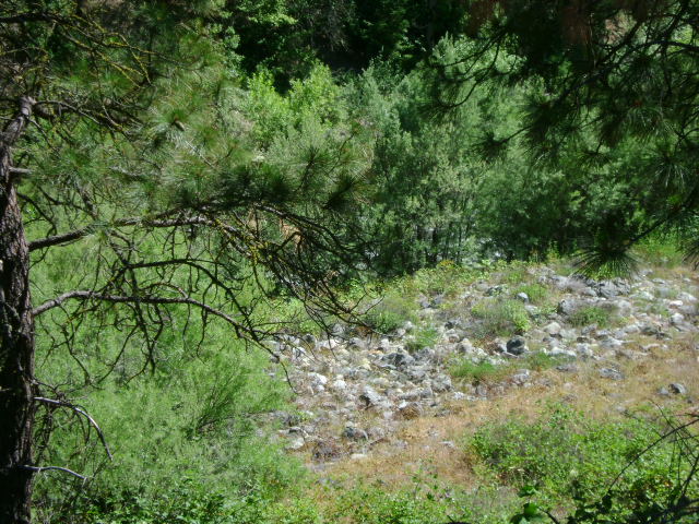
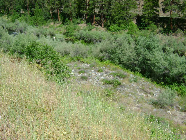
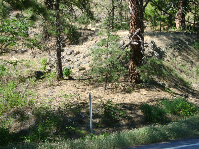
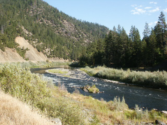
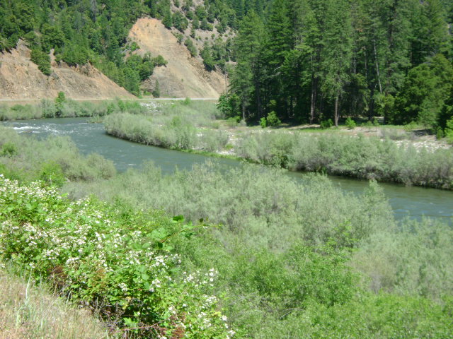
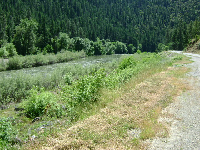
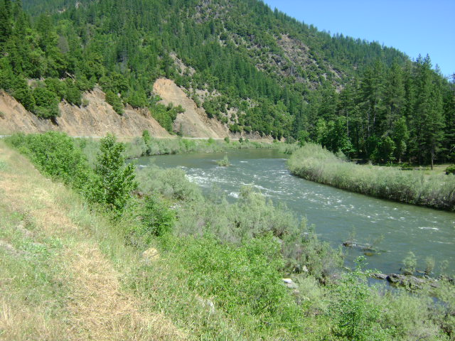
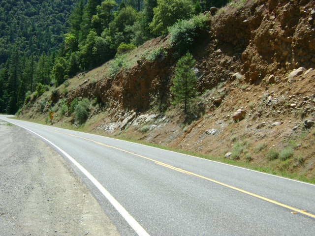
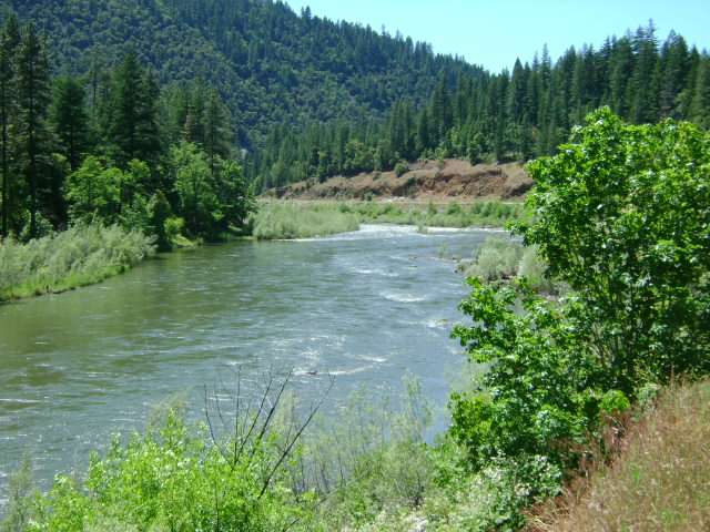
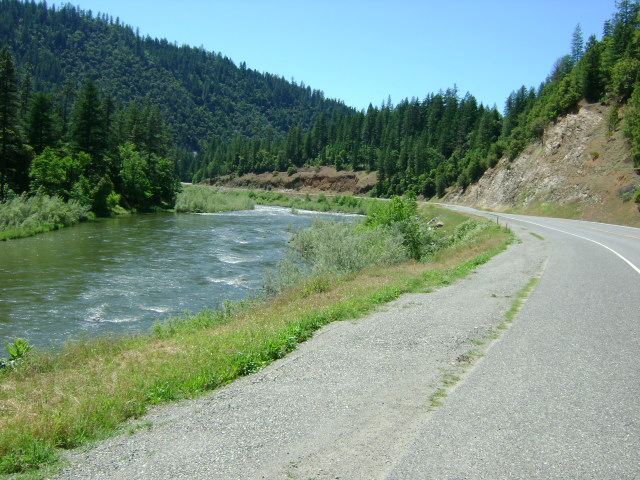
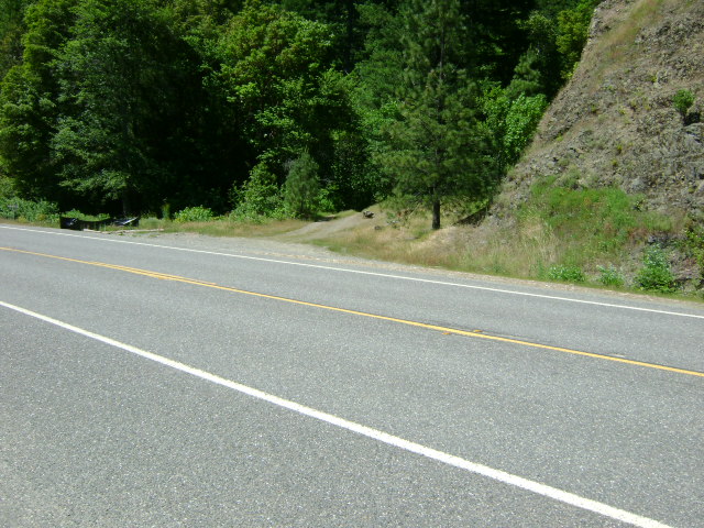
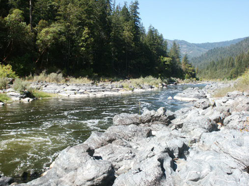
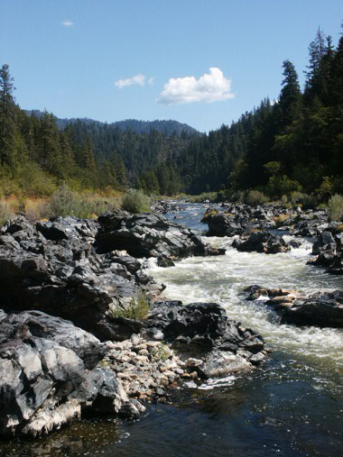
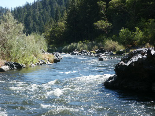
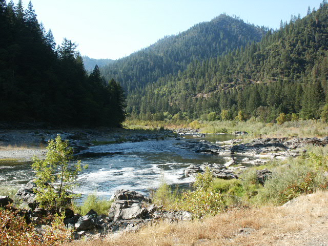
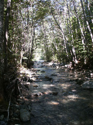
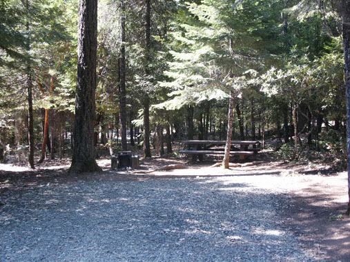
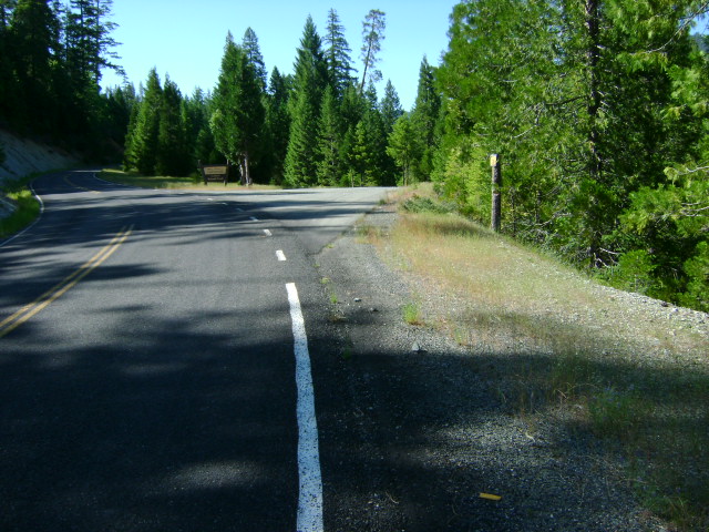
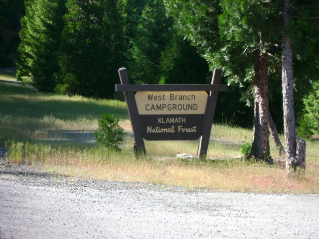
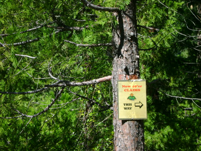
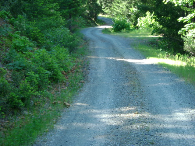
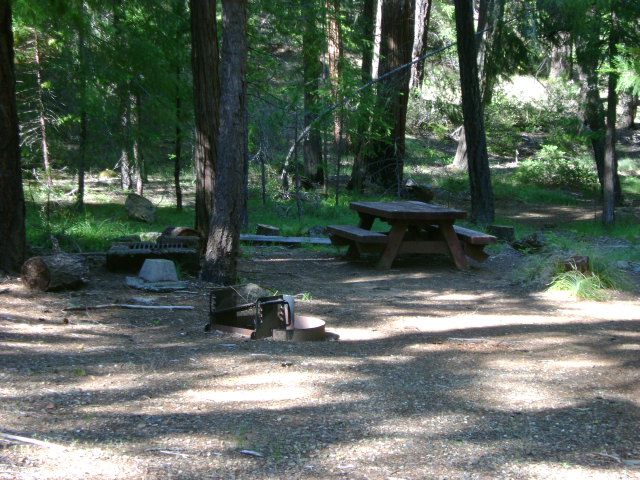
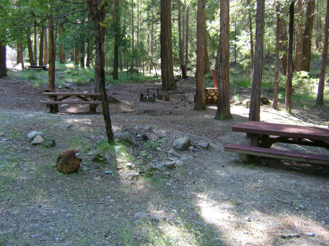
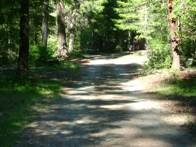
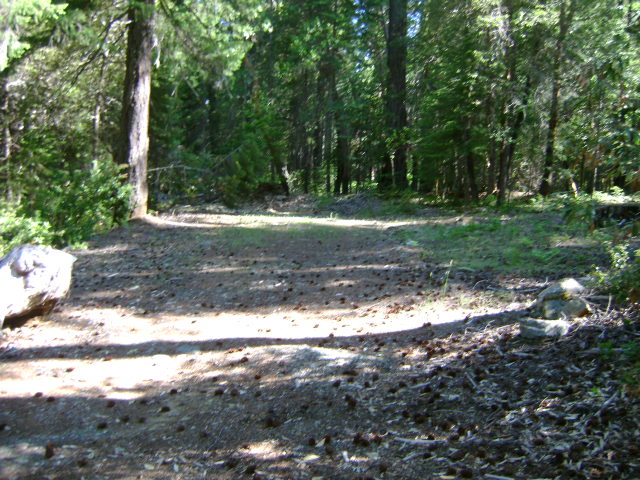
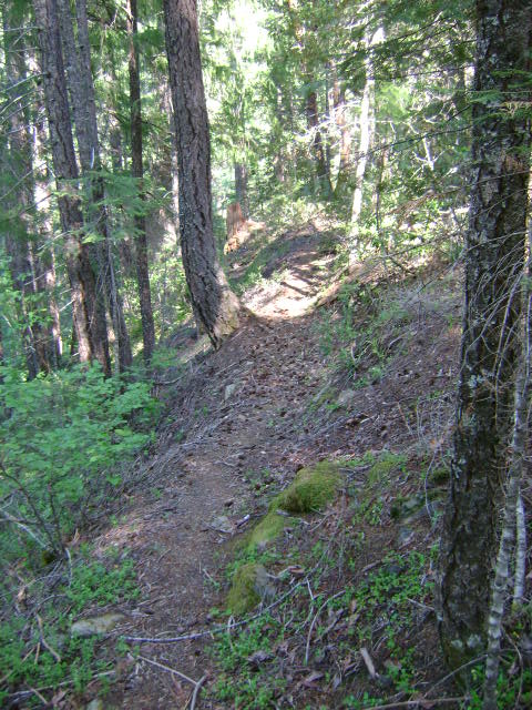
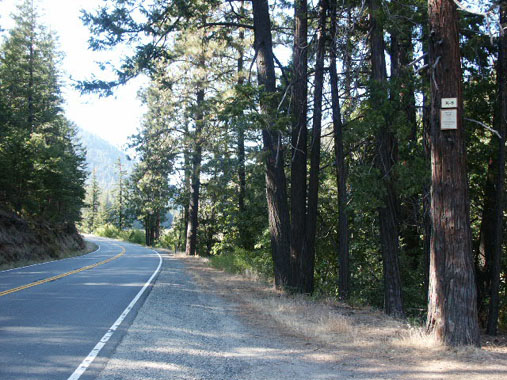
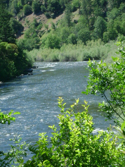
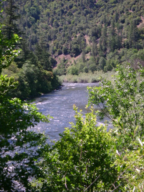
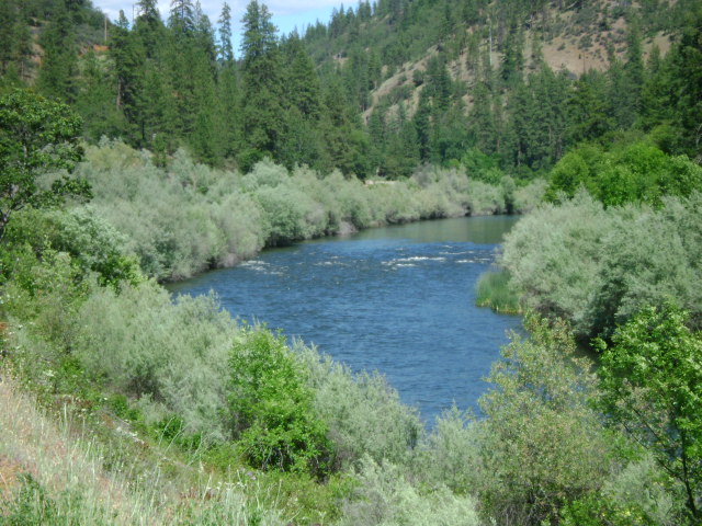
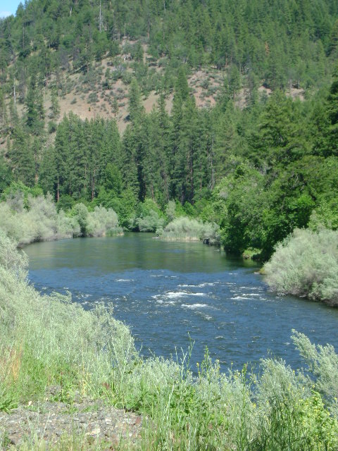
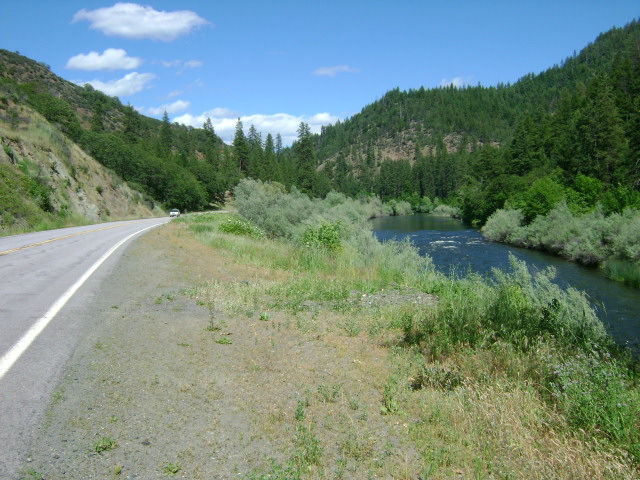
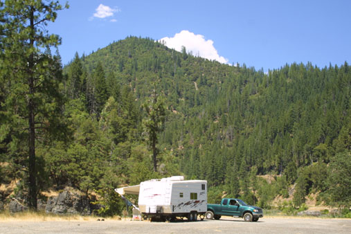
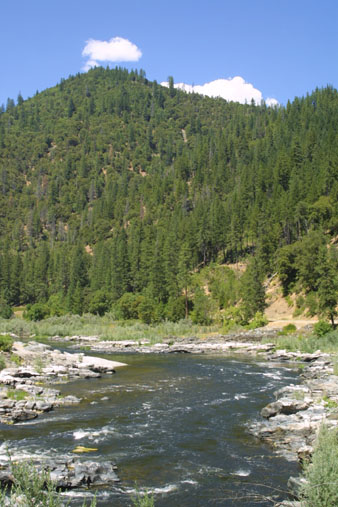
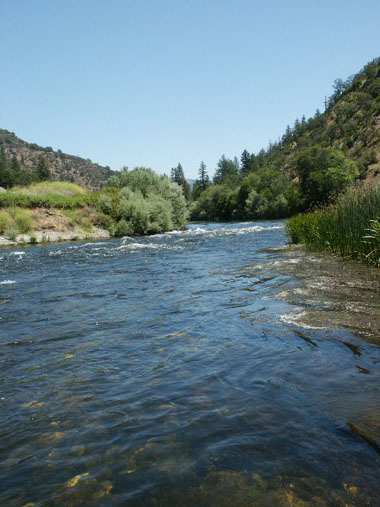
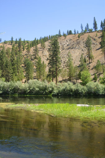
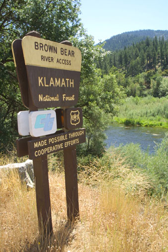
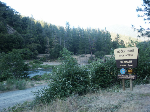
K-11 SCHUTTS GULCH CLAIMS – The downriver boundary (mile marker 63.58) is located about 3 miles upriver from where Highway 96 crosses Seiad Creek. It is located directly at the confluence of Schutt’s Gulch–which enters from the far side of the river. A lower boundary sign is on a post near the highway, directly across from Schutts Gulch. The upriver boundary (mile marker 64.73) is located about 1.5 miles upriver, adjoining private property where you will see the first home between Highway 96 and the river. The upriver boundary is posted on a tree alongside the highway. There is a small camping and USFS river access area (named “Rocky Point” at mile marker 64.46) toward the upper end of the claim (two week camping limit). Please don’t block the river access or chemical toilet! Use of the far-side camping area requires members or guests to provide your own porta-potty to meet sanitary requirements. The far side of the river, with a large campground (no extended camping permitted–two week limit) used to be accessible from Ladd Road in Seiad Valley, just upriver from the bridge where Highway 96 crosses the river. But parts of this road have been washed out and it gets very rough. We strongly suggest you look the road over once before deciding to pull any trailer to the camp-area on the other side.

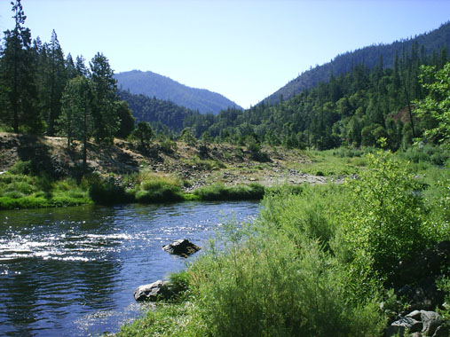
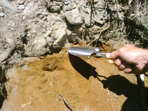
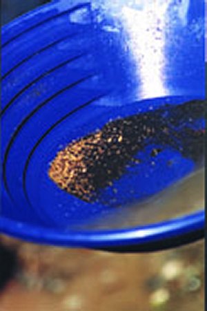
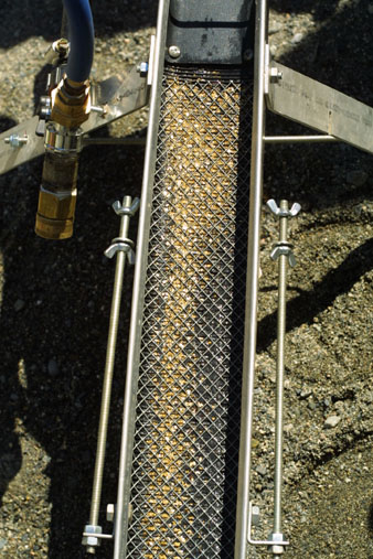
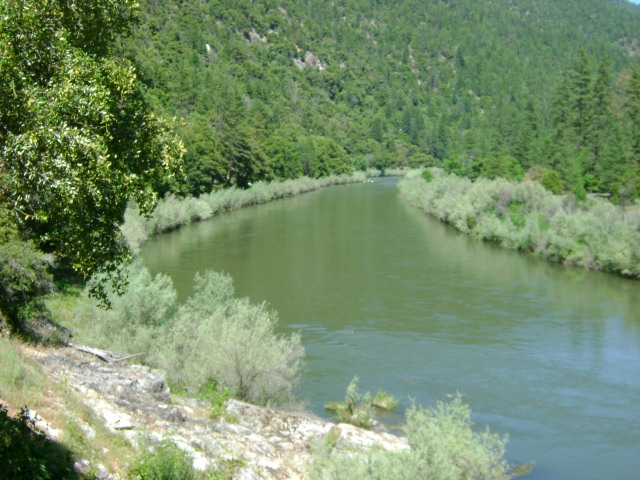
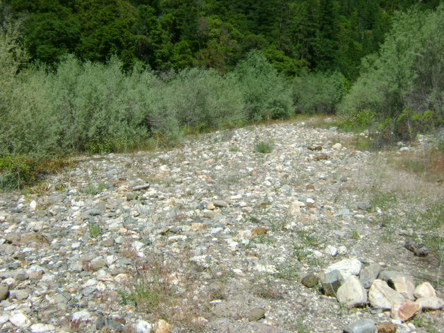
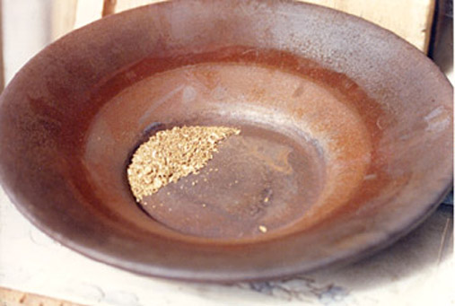
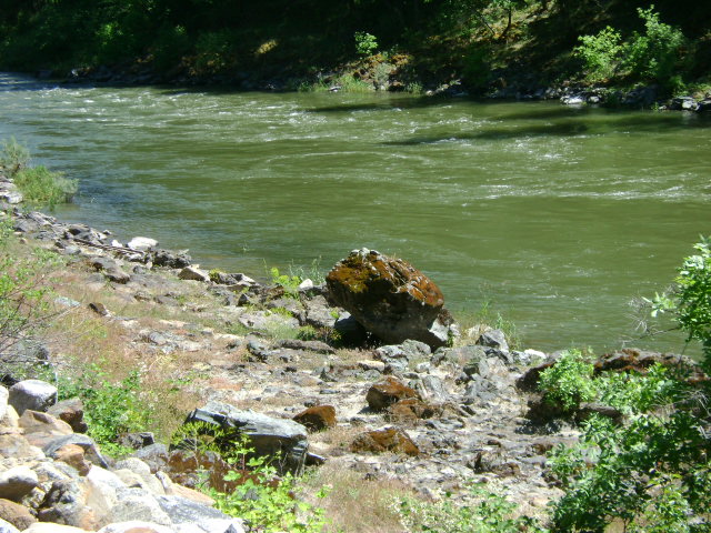
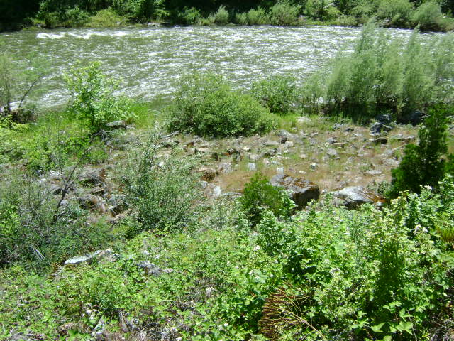
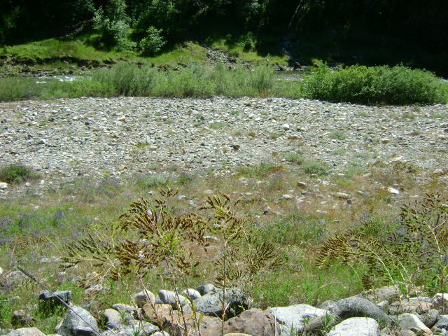
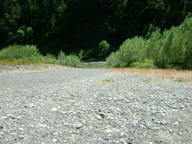
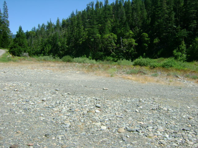
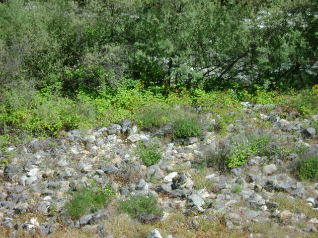
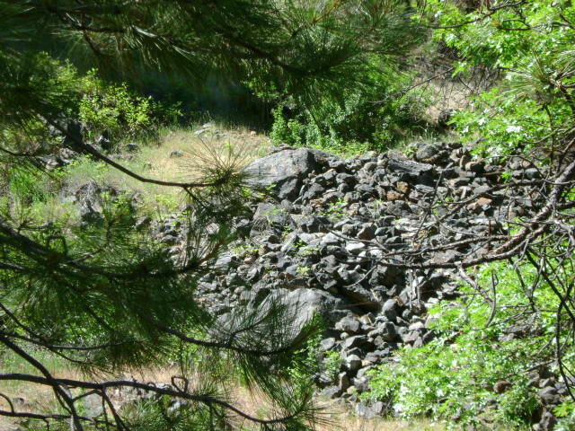
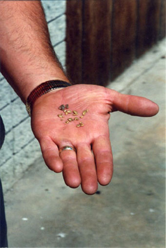
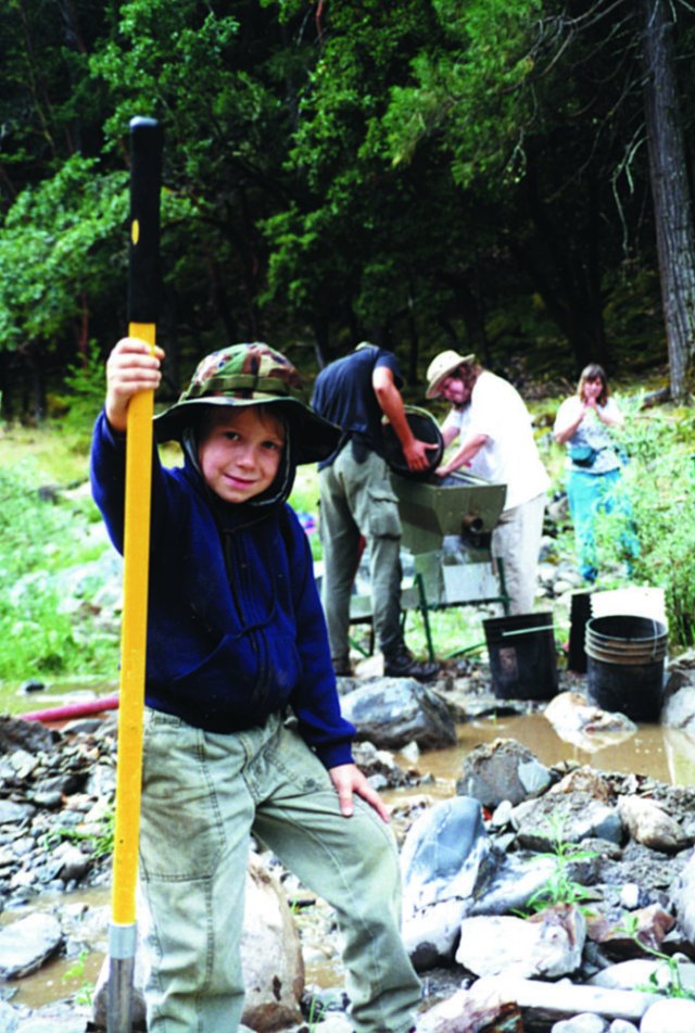
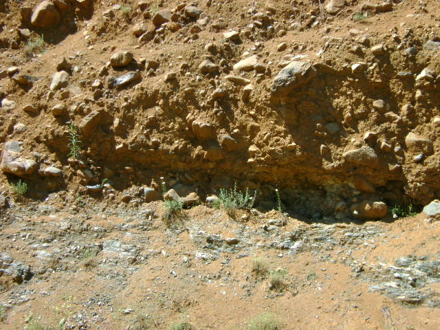
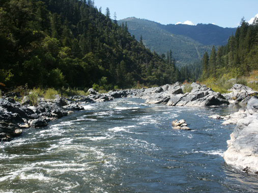
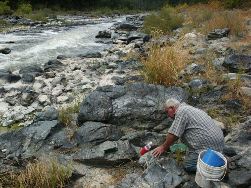
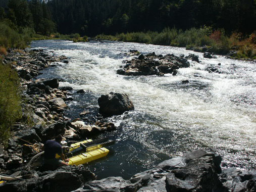
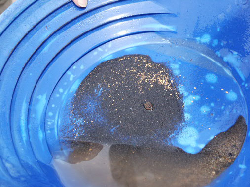
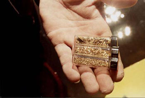
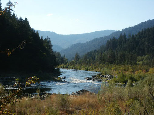
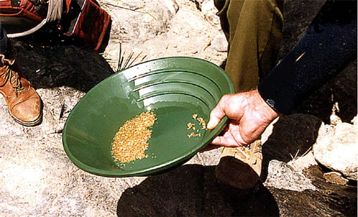
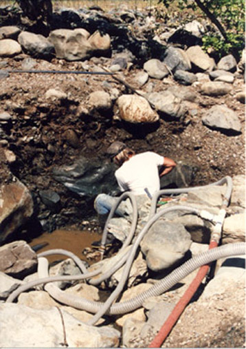
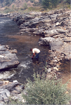
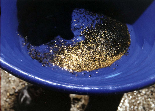
PROSPECTS: This claim has been a substantial producer of gold for our members, from top to bottom. River gravels are generally shallow to bedrock or false bedrock. Nuggets and jewelry gold have been reported. The far side, upper area has been one of the Club’s best producers for mining out of the water. Look for gold in the top 6 to 8 inches of gravel. Most of the claim has yet to be tested.

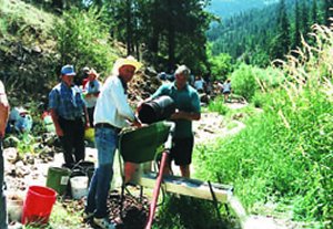
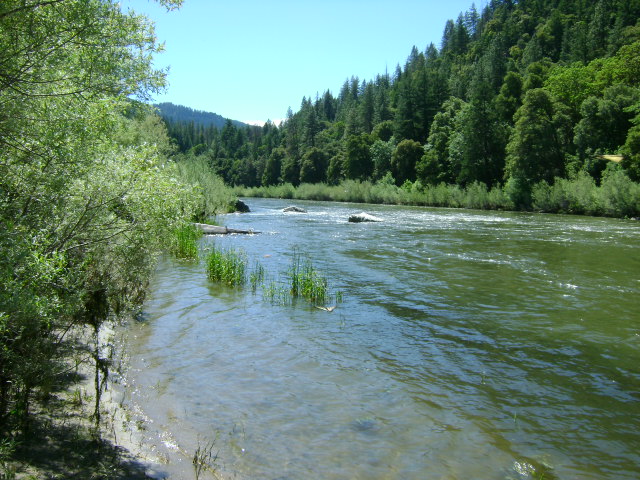
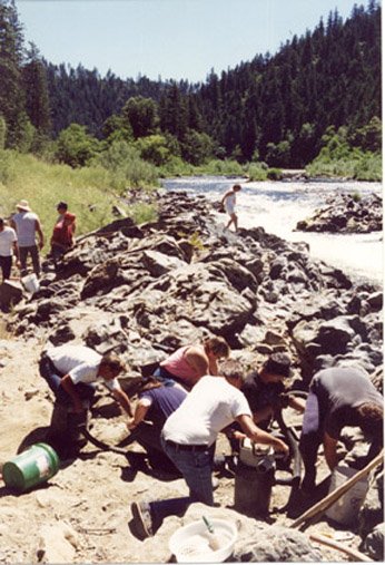
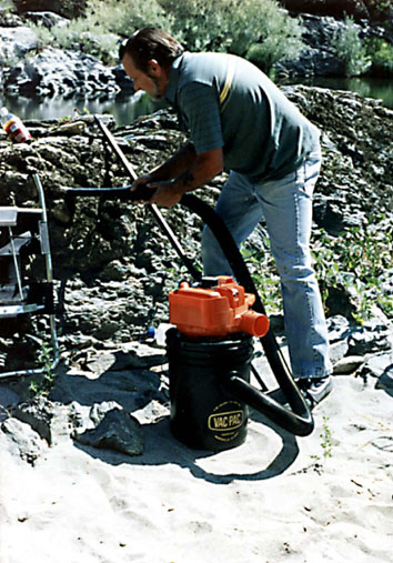
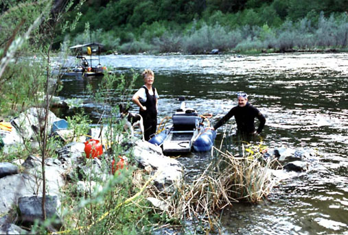
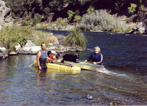
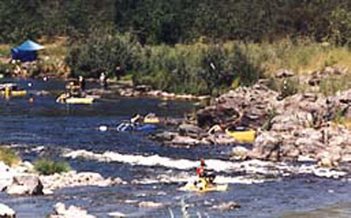
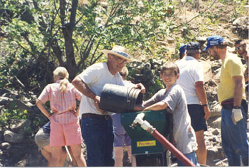
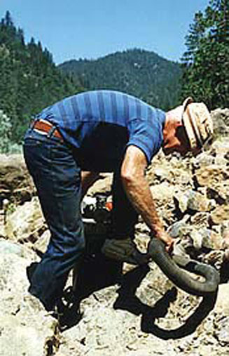
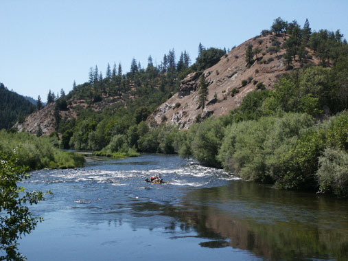
The Club sponsored a Group Dredging Project on this claim during the 2004 season, and then followed with a second project a few months later.

Click on thumbnail for larger image.


Map Thumbnail

Topo

Map Thumbnail

3D Down

Map Thumbnail

3D Up

Map Thumbnail

Aerial

Map Thumbnail

Satellite

Upper Klamath :: Upper-mid Klamath :: Mid Klamath :: Lower Klamath
Elk Creek :: Indian Creek :: Scott River :: Thompson Creek
Salmon River Main Stem :: Salmon River North Fork
Master List of Mining Properties


Important note concerning Mining & Dredging Seasons on this Property

Google Earth Coordinates: 41 50’10.5″N 123 10’31.3″W

To view the content from the link above you will need to have Google Earth installed on your home computer. Download Google Earth


Klamath River Claim K-12


K-12 UPPER SEIAD CLAIMS – are located 1.2 miles upriver from where Highway 96 crosses Seiad Creek. The Highway 96 bridge across the Klamath River serves as the lower boundary of this claim. Access to the the upper half is blocked by some private property that extends across the river, and the owners are fond of their privacy. Look for the signs the owner has posted along the river.  Therefore, access to the upriver portion must be done by boat or from Ladd Road in Seiad Valley, located just north from the bridge where Highway 96 crosses the river.

PROSPECTS: We have very little information about how members have done on this claim. However, the prospects look promising because rich gold deposits have been dredged from the river during recent years from the claims located just up and down river.

Click on thumbnail for larger image.

Map Thumbnail

Topo

Upper Klamath :: Upper-mid Klamath :: Mid Klamath :: Lower Klamath
Elk Creek :: Indian Creek :: Scott River :: Thompson Creek
Salmon River Main Stem :: Salmon River North Fork
Master List of Mining Properties


Important note concerning Mining & Dredging Seasons on this Property

Google Earth Coordinates: 41 51’8.6″N 123 13’49.1″W

To view the content from the link above you will need to have Google Earth installed on your home computer. Download Google Earth


K-13 AND K-14 LOWER SEIAD & PORTUGUESE CREEK CLAIMS – are located just upriver from the confluence of Portuguese Creek-which is approximately 3 miles downriver from where Highway 96 crosses Seiad Creek. Boundary signs posted on trees mark the downriver (mile marker 57.14) claim boundary. The upriver claim boundary (mile marker 59.14) is posted on a tree around 2 miles upriver. There is a river access on the claim named “Sluice Box”, with a small campground, just downriver from Seiad Valley. Longer-term camping is available to members on the gravel bar area toward the upper end of this claim.

PROSPECTS: These claims have been very good gold producers for members of our Club. Much of the gravel is reasonably shallow to bedrock. Lots of nuggets and jewelry gold have been recovered off the property, from the top end, to the bottom, mostly off the far side of the river. Fine and flake gold seems to concentrate towards the road-side of the river. In addition to sampling which members have done on this claim, we also confirmed this on a Group Mining Project where we also had quite a challenging adventure trying to recover beautiful gold nuggets from a deep water location. Most of the claim has yet to be adequately tested. The gravel bars on the far side of the river provide some of the Club’s best surface mining opportunities.

Click on thumbnail for larger image.

Map Thumbnail

Topo

Map Thumbnail

3D Down

Map Thumbnail

3D Up

Map Thumbnail

Aerial

Map Thumbnail

Satellite
 

Upper Klamath :: Upper-mid Klamath :: Mid Klamath :: Lower Klamath
Elk Creek :: Indian Creek :: Scott River :: Thompson Creek
Salmon River Main Stem :: Salmon River North Fork
Master List of Mining Properties


Important note concerning Mining & Dredging Seasons on this Property

Google Earth Coordinates: 41 50’9.7″N 122 56’35.4″W

To view the content from the link above you will need to have Google Earth installed on your home computer. Download Google Earth


Klamath River Claim K-4


K-4 OAK BAR CLAIMS – are located three miles downriver from the old Oak Knoll Ranger Station. The upper boundary is located at mile marker 79.61, and the lower boundary is located at mile marker 79.33. Boundary signs are well posted on trees, not far down river from Kohl Creek. The claim is approximately a half-mile long. Access is reasonably easy.

PROSPECTS: The upper boundary butts up to the Oak Bar private property-which has a very rich history of placer gold mining.

Click on thumbnail for larger image.

Map Thumbnail

Topo

Map Thumbnail

3D Down

Map Thumbnail

3D Up

Map Thumbnail

Aerial

Map Thumbnail

Satellite


Important note concerning Mining & Dredging Seasons on this Property


View of lower claim area


K-13 AND K-14 LOWER SEIAD & PORTUGUESE CREEK CLAIMS – are located just upriver from the confluence of Portuguese Creek-which is approximately 3 miles downriver from where Highway 96 crosses Seiad Creek. Boundary signs posted on trees mark the downriver (mile marker 57.14) claim boundary. The upriver claim boundary (mile marker 59.14) is posted on a tree around 2 miles upriver. There is a river access on the claim named “Sluice Box”, with a small campground, just downriver from Seiad Valley. (2 week limit).

Dredging Gold with 24 people at K-14 & K-15A!

PROSPECTS:These claims have been very good gold producers for members of our Club. Much of the gravel is reasonably shallow to bedrock. Lots of nuggets and jewelry gold have been recovered off the property, from the top end, to the bottom, mostly off the far side of the river. Fine and flake gold seems to concentrate towards the road-side of the river. Most of the claim has yet to be adequately tested. The gravel bars on the far side of the river provide some of the Club’s best surface mining opportunities.

Click on thumbnail for larger image.

Map Thumbnail

Topo

Map Thumbnail

3D Down

Map Thumbnail

3D Up

Map Thumbnail

Aerial

Map Thumbnail

Satellite
 

Upper Klamath :: Upper-mid Klamath :: Mid Klamath :: Lower Klamath
Elk Creek :: Indian Creek :: Scott River :: Thompson Creek
Salmon River Main Stem :: Salmon River North Fork
Master List of Mining Properties


Important note concerning Mining & Dredging Seasons on this Property

Google Earth Coordinates: 41 52’7.6″N 123 17’6.3″W

To view the content from the link above you will need to have Google Earth installed on your home computer. Download Google Earth


K-15 GLORY HOLE CLAIMS – The downriver boundary is located one mile upriver from the confluence of Thompson Creek. Tim’s Creek (mile marker 53.17) is the lower boundary of the Glory Hole Claims. The upper end of the Glory Hole Claim (mile marker 54.17) is located approximately one mile further upriver from Tim’s Creek, and adjoins the private property where the fenced garden is located between Highway 96 and the river. This fence marks the upper boundary of the Glory Hole, along with our boundary sign posted on a tree. K-15A (Mega-Hole) extends upriver from there. There are numerous developed paths and trails leading from Highway 96 into the Glory Hole Claims. All vehicle access to the claim is blocked by private property, although the access road to the upper end of the claim is open.

PROSPECTS:This is one of the richest claims owned by the Club, and has provided (estimated) hundreds of ounces of gold to members during past years. Much of the river has been dredged on these claims, and a large portion of the bank on the Highway 96-side of the river has been mined. The far bank remains relatively undisturbed because access requires a boat. Bedrock, or false bedrock, is generally shallow on these claims. A good portion of the lower claims has not been dredged yet. Therefore, it is likely that rich deposits still remain in place for the finding, both in the river, and all along the far bank. The rapids along the center of the claim have yet to be cleaned out, and offer excellent potential for experienced members.

The Club sponsored a Group Dredging Project on this claim during the 2004 season.

Click on thumbnail for larger image.
       

Map Thumbnail

Topo

Map Thumbnail

Lower 3D Down

Map Thumbnail

Lower 3D Up

Map Thumbnail

Upper 3D Down

Map Thumbnail

Upper 3D Up

Map Thumbnail

Aerial lower

Map Thumbnail

Aerial Upper

Map Thumbnail

Satellite

Upper Klamath :: Upper-mid Klamath :: Mid Klamath :: Lower Klamath
Elk Creek :: Indian Creek :: Scott River :: Thompson Creek
Salmon River Main Stem :: Salmon River North Fork
Master List of Mining Properties


Important note concerning Mining & Dredging Seasons on this Property

Google Earth Coordinates: 41 55’54.6″N 123 28’28.7″W

To view the content from the link above you will need to have Google Earth installed on your home computer. Download Google Earth


I-3 WEST BRANCH OF INDIAN CREEK CLAIMS(Note; this road access was washed out during a storm in 2016) These claims are located 9/10 of a mile up Indian Creek Road from the last Indian Creek bridge-or approximately just short of 12 miles up Indian Creek Road from Happy Camp. Look for the U.S. Forest Service “West Branch” campground sign on the right side. The access road will *cross a bridge and lead into the campground, where you can take a right turn onto a one-way drive through, or you can go straight-which will lead you to another access road (#18N31A), which will go through a gate and take you near a creek access point further upstream. This road is somewhat primitive, so members should be cautious. The one-way road through the campground will lead you down toward the creek, where we have several trails leading directly to the creek. Watch for our signs. The boundary sign at the lower-creek boundary is posted on a tree about 1/4 mile downstream from the campground. The upper-creek boundary is so far up there, you will probably have difficulty finding the sign. Camping (for a fee) is allowed for two weeks in the developed Forest Service campground. Members wanting to stay longer may camp in a special access area at the lowest end of the campground. Watch for signs.

*This bridge was destroyed during the January flood of 2006, and is temporarily closed to vehicle traffic.

PROSPECTS: We had a number of members working the lower end of these claims, below the campground, several years ago-and all of them were excited about the gold they were recovering. Some large nuggets were found, along with lots of jewelry gold. Gravel depth was around 2-3 feet in this area. The gold was along the bedrock. Most of the claim has yet to be tested. Some reports by members indicate that the gravel may be deeper further upstream on the claims. We have a few reports that good gold has also been found on the upper end of the claims. This is not surprising in view of the gold being recovered off the lower end. The prospects are very good!

Click on thumbnail for larger image.

Map Thumbnail

Topo Lower

Map Thumbnail

Topo Upper

Map Thumbnail

3D Down

Map Thumbnail

3D Up

Map Thumbnail

Aerial lower

Map Thumbnail

Aerial Upper

Map Thumbnail

Satellite


Important note concerning Mining & Dredging Seasons on this Property

Google Earth Coordinates: 41 49’51.5″N 122 57’25.9″W

To view the content from the link above you will need to have Google Earth installed on your home computer. Download Google Earth


K-5 TEN SPOT CLAIM – The upper boundary is located at mile marker 79.00, and the lower boundary is located at mile marker 78.65. The boundary signs are well posted on trees alongside Highway 96. Access is reasonably easy.

PROSPECTS: This claim is located just upriver from our Brown Bear claims (K-6) which are producing very well, so the prospects are promising.

Click on thumbnail for larger image.

Map Thumbnail

Topo

Map Thumbnail

3D Down

Map Thumbnail

3D Up

Map Thumbnail

Aerial

Map Thumbnail

Satellite


Important note concerning Mining & Dredging Seasons on this Property

Google Earth Coordinates: 41 51’49.1″N 123 16’6.1″W

To view the content from the link above you will need to have Google Earth installed on your home computer. Download Google Earth


K-15A MEGA HOLE – The Mega Hole claims are quite long, the upriver boundary being located on a tree between the river and Hwy 96 near mile marker 55.62, about a ¼-mile below Fort Goff Creek – which is located about four miles upriver from Thompson Creek. The downriver boundary butts up against the Upper Glory Hole claims (K-15 at lower-Savage Rapids). Fort Goff Creek is easy to find, because there is a developed rest area at that location. There are also a few parcels of private property between Highway 96 and the river, toward the lower end of the Mega Hole claim. These parcels are posted. Otherwise, there is good access to most of the Mega Hole. The lowest parcel of private property, just above the Glory Hole, is a developed garden with a fence around it. That parcel extends 20 feet out into the river. Otherwise, most of the river is included along our mining claim. Longer-term camping areas for members are located on both sides of the highway, near Savage Rapids (mile marker 55.13), including on the large highway pull-off.

PROSPECTS: The Mega Hole has been one of the Club’s richest mining properties, with members recovering (estimated) hundreds of ounces of gold during recent years. Much of the lower portion of the Mega Hole has been dredged, although there are areas that were missed. The surface gold (out of the water) is excellent on both sides of the river, with nugget-sized gold being recovered off the Highway-96 side. Bedrock can be shallow to deep, depending on where you go. The upriver end of the claim still shows excellent potential for dredging since it has not yet been adequately tested.

The Club sponsored a Group Dredging Project on this claim during a recent season. We did so well, that we followed up with another dredging project and struck high-grade at the upper-end of the claim.

Dredging Gold with 24 people at K-14 & K-15A!

The Club then sponsored a Surface Mining Project on this claim. The high-banking was so good, that we followed up with another surface mining project and struck a high-banking production record at the top-end.

Click on thumbnail for larger image.


Map Thumbnail

Topo

Map Thumbnail

3D Down

Map Thumbnail

3D Up

Map Thumbnail

Aerial

Map Thumbnail

Satellite
 

Upper Klamath :: Upper-mid Klamath :: Mid Klamath :: Lower Klamath
Elk Creek :: Indian Creek :: Scott River :: Thompson Creek
Salmon River Main Stem :: Salmon River North Fork
Master List of Mining Properties


Important note concerning Mining & Dredging Seasons on this Property

Google Earth Coordinates: 41 49’24″N 122 57’47.3″W

To view the content from the link above you will need to have Google Earth installed on your home computer. Download Google Earth


K-6 BROWN BEAR CLAIMS – are located six miles up the Klamath from its confluence with the Scott River. The claim is located 1/2 mile upriver from the Walker Creek Bridge-which is where Highway 96 crosses the Klamath River. This bridge is about a mile upriver from Horse Creek. The upriver claim boundary is marked on a tree down the hillside from Highway 96 at mile marker 78.50. The downriver boundary (mile marker 77.86) is also well posted on a tree along Highway 96, across from the Klamath River Elementary School-which is visible from the highway. There is a developed river access (mile marker 77.97) and campground toward the upper end of the claim. Look for the USFS access sign along the road. The far side of the river can also be accessed by driving along Walker Creek Road, which is located just downriver from the Walker Creek Bridge. There is some private property on the far side of the river between Walker Creek Road and the river-watch for signs. Access is relatively easy from the Highway 96-side. The Forest Service restricts Club camping in this campground to a 2-week limit.

PROSPECTS: This claim has been producing good gold deposits for suction dredgers in relatively shallow gravel, on both sides of the river and the center. Most of the activity so far has been in and around the rapids located just down from the campground. For the most part, the claim has not yet been sampled and mined. The Club sponsored a Group Dredging Project on K-6, and recovered around several ounces of gold in around 5 days of work. You can read about the adventure at Two Gold Strikes At Brown Bear (K-6).

Click on thumbnail for larger image

Map Thumbnail

Topo

Tags