Search Results : rif


By Michael Burnside, June 17, 2005

In 1897, Congress passed the Organic Act, which established the National Forest System and the purposes for which it would be managed. In regard to mining, the 1897 Act said that while the Forest Service couldn’t prohibit activities reasonably incidental to mining under the 1872 General Mining Law, the Forest Service was authorized to create reasonable rules to regulate the adverse effects of mining activities on the National Forests, and miners had to comply with those rules. In 1974, the Forest Service finally wrote those regulations. Since 1974 was the first attempt at rule making to oversee the surface effects of mining, the rules had imperfections and there were concerns over the years about their interpretation and application. But the Forest Service was largely consistent in how it interpreted them and in the manual direction it issued to apply its 36 CFR 228A regulations to minimize adverse environmental impacts from mining activities. In short, the Forest Service logically focused on the likely impacts of proposed mining activities, and required miners to submit plans of operations for all activities which would likely cause significant surface disturbance, regardless whether those activities involved mechanized earth moving equipment or the cutting of trees.

Activities which do not necessarily involve mechanized earth moving equipment or the cutting of trees could include construction of ore processing mills and mill sites; residential construction and occupancy; major hand excavation of holes, trenches, and pits in stream areas; road and bridge construction; disposal of mine tailings and other wastes; signing and fencing to restrict public use; diversion of water; and use of sluice boxes; storage of vehicles; and off highway vehicle use. While none of these activities may involve mechanized earth moving equipment or cutting of trees, they obviously could cause significant surface disturbance. Inability of the Forest Service to regulate such activities could result in significant impacts to NFS lands and resources and would violate the stated purpose of the 36 CFR 228A regulations to minimize adverse effects from mining. Numerous court decisions over the years, including 1981 US v. Weiss; 1989 U.S. v. Doremus; 1986 U.S. v. Brunskill; and 1990 U.S. v. Burnett; had upheld the Forest Service’s authority to apply its regulations in this manner and for this purpose.

In 2003, the judge who issued the Lex decision focused on the wording in one section of the Forest Service’s 1974 regulations and interpreted it in a manner that was directly contrary to how the Forest Service had been historically interpreting its regulation. In summary, the Judge said that based on the words the Forest Service had used in its regulations in 1974, it could not regulate operations which do not involve the use of mechanized earth moving equipment, such as bulldozers and backhoes, or cutting of trees.

As indicated previously, if this 2003 judicial interpretation of the 1974 rule had been allowed to stand, it would have overridden other language in 36 CFR Part 228 Subpart A which required miners to file a plan of operations for significant surface disturbing activities. The Lex court’s interpretation of the Forest Service’s rules conceivably could have allowed construction and operation of mills; deposition of tailings and mine waste; construction and occupation of residencies and buildings; and a long list of other examples, all without Forest Service oversight or bonding. The effect of such a broad exemption would have been contrary to Forest Service statutory authority and obligation to regulate mining on National Forests, and almost certainly would have caused a major adverse public reaction to such unregulated mining activities on public lands.

The judge who wrote the Lex decision was sympathetic with the dilemma his decision placed upon the Forest Service. The court referenced the Forest Service’s continuing authority to write regulations, and suggested that the Forest Service modify the 36 CFR 228 A regulations to fix the situation. Rather than appeal the Lex decision, which was indeed an option, the Forest Service believed the better long term solution was to do as the judge suggested and revise its regulation, which resulted in this final rule. The Forest Service used this situation as an opportunity to clarify its rules and address issues raised in the extensive public comment on the rule.

The June 6, 2005, Federal Register notice with the new rule at 36 CFR 228.4(a) and its Preamble contains several things that miners in general and small operators in particular should take note of:

1.) The Rule has been reorganized to make it flow more logically and to parallel the progression of activities from low impact or no impact to those requiring a plan of operations.

2.) The Preamble acknowledges that there is some confusion about how these regulations apply to “recreational miners”, and that some opponents to suction dredging assert that recreational mining is not legal under the mining law. The Forest Service makes it clear in the Preamble that it does not matter how operations are described, whether as recreational or commercial. As long as the operations are all reasonably incidental to mining, the same rules apply to all miners.

3.) Some members of the public have argued that a plan of operations should be required for any suction dredging operations and some miners have argued that suction dredging should be exempt from a Notice of Intent or a Plan of Operations. The Preamble explains that a “one size fits all” determination cannot be applied to suction dredging, and it must be made on a site-specific basis because of the great variability in circumstances and resource sensitivities on National Forests. Therefore it is possible that in some settings, a suction dredge operation may be exempt (perhaps under 228.4(1)(vi)) from needing a notice of intent or plan of operations and other circumstances where a Plan would be necessary if the operation would likely cause a significant surface disturbance.

4.) The new rule does not change bonding or other enforcement provisions available to the Forest Service against miners. Those remain the same as they have always been.

5.) The Preamble explains these regulations do not preclude or conflict with California State suction dredging permits, and that the state and federal permitting can and should be read together.

6.) The Forest Service has committed in the Preamble to train Forest Service mineral administrators to insure consistent interpretation and application of this new rule. In addition, the Chief of the Forest Service issued separate guidance in November 2004 that all mineral administrators must become trained and certified in the application of these regulations.

7.) The Preamble clarifies that the term “significant” as used in 36 CFR 228A is NOT used in the same way as under the National Environmental Policy Act (NEPA). The Preamble also explains the standard for determining significance under 36 CFR 228A. Any District Ranger’s decision that a proposal “…will likely cause significant disturbance of surface resources…” must be (1.) demonstrably based on past experience, direct evidence, or sound scientific projection; that would (2.) lead the District Ranger to reasonably expect the proposed operation to result in impacts to National Forest System lands that would need to be avoided or mitigated by reclamation, bonding, timing restrictions, or other measures to minimize adverse effects.

8.) The Preamble explains that stream beds in National Forests which have been adjudicated and determined to be navigable when the particular State entered the Union are exempt from Forest Service regulations. All others are subject to Forest Service regulation. Forest Service Regional Offices or the appropriate states should be able to provide a list of those streams.

9.) The Preamble explains that in spite of the original wording in the 1974 rule stating a Notice of Intent must be filed for any disturbance, careful research of the record for the 1974 rule revealed there was never any intent to require Notices of Intent for all activities which might cause a disturbance. The original intent was to require a Notice of Intent for only those operations which might (but are not likely to) cause SIGNIFICANT disturbance to surface resources and thus might require the filing of a Plan of Operations. Therefore, this final rule was changed to include the word “significant” in the context of requiring a Notice of Intent. Only operations; which might cause significant disturbance now require the filing of a Notice of Intent.

The Preamble also emphasizes that a Notice of Intent is not a regulatory instrument, permit, or “mini-plan”. A Notice of Intent is simply a notice the operator provides to the Forest Service to alert them and to help the process along, since it is in both their interests to do so.

10.) The Preamble clarifies that the trigger for a Notice of Intent is an operator’s reasonable uncertainty as to the significance of the disturbance the proposed operations will cause on National Forest System resources. If an operator reasonably concludes operations will not cause significant disturbance of NFS resources, the operator is not required to submit an NOI or POO.

The District Ranger may disagree with this and require a Plan of Operations. However, the Ranger’s decision must be based on past experience, direct evidence, or sound scientific projects that would lead the Ranger to reasonably expect the proposed operation to result in impacts to National Forest System lands that would need to be avoided or mitigated by reclamation, bonding, timing restrictions, or other measures to minimize adverse effects. Under Forest Service appeal regulations, an operator would have the right to challenge this decision.

11.) The new rule clarified and added to the list of activities exempt from filing Notices of Intent or Plans of Operation, including the following:

a.) Under the new rule, vehicle use on existing roads, removal of small mineral samples, marking and monumenting claims, and underground operations which will not cause significant surface resource disturbance, will continue to not require an NOI or POO.

b.) The new rule added specifics to the exemption from filing a Notice of Intent or Plan of Operations at 228.4 (a)(1)(ii). Gold panning, non-motorized hand sluicing, battery operated dry washers, metal detecting, and collecting of mineral specimens using hand tools have been added.

c.) The Preamble clarifies the wording in this exemption about removal of a “reasonable amount of mineral deposit for analysis and study” to mean removal of amounts consistent with commonly accepted standards for taking stream sediment samples such as those listed in the U.S. Bureau of Mines publication, “Standard Procedures for Sampling” (sample size of 200 gms.), and Peter’s “Exploration and Mining Geology” (50 to 100 gms. every 50 to 100 meters). Peters recommendation for hard rock samples is 500 gm. to 2 kg. in size.

d.) The final rule also includes a new exemption to insure that miners are not treated to a different standard than other Forest users. It provides that miners are exempt from filing a Notice of Intent or Plan of Operations when their proposed activities have effects which are not substantially different from other non-mining activities for which no prior permission or authorization is required. If the Forest Service allows activities by other Forest users without requiring a permit, and those activities have the same effects as those conducted by miners, the miners’ activities should be exempted from an NOI or POO as well.

In summary, the discussion in the Preamble is well worth reading since it explains the background and proper interpretation and intent of this new rule.


Northwest Mining Association Comments

on USFS proposed Section 261 Rule changes

July 3, 2007

Forest Service, USDA
Attention:
Director, Minerals and Geology Management (MGM) Staff (2810)
Mail Stop 1126
Washington, DC 20250-1126

Re: Proposed Amendments to 36 CFR 261.2 & 261.10 F2 Fed. Reg. 26578

Northwest Mining Association (NWMA) is a 112 year-old, 1,650 member non-profit, non-partisan trade association based in Spokane, Washington. Our members reside in 33 states and are actively involved in prospecting, exploring, mining, and reclamation closure activities on USFS administered land. Our membership represents every facet of the mining industry, including geology, exploration, mining, engineering, equipment manufacturing, technical services, legal services, and sales of equipment and supplies. Our broad-based membership includes many small miners and exploration geologists, as well as junior and large mining companies. More than 90% of our members are small businesses or work for small businesses.

NWMA’s members have extensive knowledge of the General Mining Laws of the U.S., the 36 CFR 228A and 261 regulations, the Surface Resources Act of 1955, administrative and judicial decisions interpreting those laws, and the issues raised in the proposed rule.

We are aware of case law that supports the Forest Service using 36 CFR 261 for enforcement of its 36 CFR 228A mining regulations in certain circumstances. However, we also are aware of many cases where the Forest Service has inappropriately or illegally used this enforcement regulation. We believe the 261 rule, as proposed, will only increase the potential for misuse by overzealous Forest Service officers and complicate things further for the Forest Service and miners. Thus, we believe the rule needs additional changes and submit the following comments explaining those needed changes.

The Forest Service needs to make it very clear in the proposed rule that for a miner to be charged under 36 CFR 261, the Forest Service must first demonstrate that the miner has violated 36 CFR 228 Subpart A. Thus, the 261 regs need to explain more fully that the phrase added at sections 36 CFR 261.10 (a), (b), and (p) “. . . approved operating plan when such authorization is required” severely restricts Forest Service use of 36 CFR 261 against miners because 261 cannot be used unless the Forest Service first demonstrates that there is a violation of 36 CFR 228A and that a Plan of Operations is required.

The Forest Service also needs to explain in the proposed 261 rule under what circumstances it will use criminal enforcement measures and when it intends to use civil measures. The Forest Service should further explain how the Forest Service Manual (FSM) policy direction fits into this determination, and how the agency will monitor, manage, and restrict rampant abuse by untrained, unqualified and/or hostile Forest Service officers of the criminal citation procedures against miners. At FSM 2817 and elsewhere, the Forest Service commits to only having certified qualified minerals’ administrators and inspectors involved in determining when an operation is in compliance.

2817. Inspector Qualifications. Inspection shall be conducted by Forest officers who are familiar with the equipment and methods needed to find and produce minerals and who can accurately assess the significance of surface resource disturbance. Inspectors should be capable of identifying those activities of an operator which are reasonably necessary to the operation, which ones could perhaps be done differently with less effect on surface resources without endangering or hindering the operation, and which ones are unreasonable or unnecessary.

Consistent with this policy, the proposed amendment to 36 CFR 261 should require a Forest Service law enforcement officer to work only with, and rely upon, an official Forest Service Certified Minerals Administrator to determine and document that an operation is in violation of 36 CFR 228A prior to issuing a violation notice under 261 (emphasis added).

The Forest Service also should explain how it intends to reconcile its use of 36 CFR 261 with the noncompliance procedures already existing at 36 CFR 228.7 (as well as a miner’s appeal rights and the appeal procedures at 36 CFR 251):

Sec. 228.7 Inspection, noncompliance.

(a) Forest Officers shall periodically inspect operations to determine if the operator is complying with the regulations in this part and an approved plan of operations. (b) If an operator fails to comply with the regulations or his approved plan of operations and the noncompliance is unnecessarily or unreasonably causing injury, loss or damage to surface resources the authorized officer shall serve a notice of noncompliance upon the operator or his agent in person or by certified mail. Such notice shall describe the noncompliance and shall specify the action to comply and the time within which such action is to be completed, generally not to exceed thirty (30) days: Provided, however, that days during which the area of operations is inaccessible shall not be included when computing the number of days allowed for compliance.

Note that the above regulation requires a miner to be served notice prior to the FS taking an enforcement action. Since this notice is a Forest Service decision, consistent with 36 CFR 228.14, a miner should be given an opportunity to appeal it under 36 CFR 251. In addition, FSM 2817 requires the Forest Service, except in emergency circumstances, to work with the miner to secure willing compliance, then issue a notice of noncompliance, and then give appeal rights prior to taking action. How does the Forest Service intend to reconcile these requirements with the 36 CFR 261 procedures?

2817.3 – Inspection and Noncompliance

1. Under Approved Operating Plan. When activities are being conducted under an approved operating plan, regular compliance inspections must be conducted to ensure reasonable conformity to the plan and to guard against unforeseen detrimental effects. The frequency, intensity, and complexity of inspection shall be commensurate with the potential for irreparable and unreasonable damage to surface resources.

2. Without Operating Plan. When operations are being conducted without an operating plan because it was determined none was required, the need for regular inspections shall be determined on a case-by-case basis. Timely inspections shall help assure conformance to the environmental protection requirements of the regulations, as well as identify operations that vary from those described in the notice of intention and which may require an operating plan.

3. Detection. Forest officers shall make note of, and report all operations for which there have not been submitted either notices of intention to operate or operating plans. Such operations shall be identified and inspected as soon as practicable to determine if a plan of operations or a notice of intent is required.

4. Inspector Qualifications. Inspection shall be conducted by Forest officers who are familiar with the equipment and methods needed to find and produce minerals and who can accurately assess the significance of surface resource disturbance. Inspectors should be capable of identifying those activities of an operator which are reasonably necessary to the operation, which ones could perhaps be done differently with less effect on surface resources without endangering or hindering the operation, and which ones are unreasonable or unnecessary.

5. Noncompliance. Wherever practicable, acts of noncompliance should be discussed with the operator, either in person or by telephone, in an attempt to secure willing and rapid correction of the noncompliance. Such discussions shall be made a matter of record in the operator’s case file. Where the operator fails to take prompt action to comply and the noncompliance is unnecessarily or unreasonably causing injury, loss or damage to surface resources, the authorized officer must take prompt noncompliance action. For direction to resolve unauthorized residential occupancy on mining claims. See FSM 2818.

a. Notice of Noncompliance. The first step in any noncompliance action is to serve a written notice of noncompliance to the operator or the operator’s agent, in person, by telegram, or by certified mail. This notice must include a description of the objectionable or unapproved activity, an explanation of what must be done to bring the operation into compliance, and a reasonable time period within which compliance must be obtained. Continued refusal of the operator to comply after notice will usually require enforcement action.

b. Enforcement Action. Civil or criminal enforcement, or a combination of both, are available for enforcement of 36 CFR 228. The decision on which procedure, or combination, to use shall depend upon the particular facts in each case and the probability of success and possible consequences. The Regional mineral staff or the local Office of General Counsel shall be consulted for advice prior to any enforcement action to ensure consistency and conformance with mineral law and regulation. The appropriate U.S. Attorney shall be consulted to coordinate the criminal and civil actions.

(1) Civil Action. Two types of civil relief in Federal District Court are available: damage recovery and injunctive. An action to recover costs of repairing damages or to compensate for irreparable damages would be appropriate for those cases where such damages have already occurred and no further operations were being conducted or likely to be conducted. Such damage suits require extended periods of time for completion. Injunctive relief can be obtained quickly when the facts of a particular case warrant such action. There must be strong justification that the party requesting relief is suffering or will suffer irreparable harm and that harm must usually be incompensible. Moreover, it must be likely that the complainant will actually succeed on the merits of the case.

(2) Criminal Action. In cases where unnecessary and unreasonable damage is occurring and where reasonable attempts fail to obtain an operating plan or to secure compliance with an approved operating plan, the operator may be cited for violation of the appropriate section of 36 CFR 261 or 262, according to existing delegation of authority.

The above quoted policy statement from FSM 2817.3 (5)b(2) commits the Forest Service to only using 36 CFR 261 where unnecessary and unreasonable damage is occurring, and where reasonable attempts to obtain compliance with the 36 CFR 228 Subpart A regulations have failed. This means the procedures at 36 CFR 228 Subpart A must be used first to evaluate and demonstrate the need for the Forest Service to take an enforcement action. To avoid premature use and/or misuse of 36 CFR 261, this FSM direction on when to use 261 against miners needs to be incorporated as part of the new proposed 36 CFR 261 regulation.

A good example of potential abuse is the fact that some Forest Service Regions have arbitrarily set a recreational camping time limit of 14 days for all forest users. We believe the Regions should be distinguishing between those users who are just recreationists and those who are miners operating under the General Mining Laws. If an operator asserts he is operating under the Mining Law, documents that he needs to camp at a site beyond 14 days to conduct activities reasonably incident to his mining operations, and shows that his activities are not likely to cause significant disturbance of surface resources, the Forest Service is obligated to consider the facts of the miner’s case prior to taking enforcement action under 36 CFR 261. In other words, the Forest Service must first demonstrate that the activity requires a Plan of Operations and does not qualify for an exemption to a notice of intent or plan of operations under 36 CFR 228.4(a) before using 36 CFR 261:

(1) A notice of intent to operate is not required for:

(i) Operations which will be limited to the use of vehicles on existing public roads or roads used and maintained for National Forest System purposes; (ii) Prospecting and sampling which will not cause significant surface resource disturbance and will not involve removal of more than a reasonable amount of mineral deposit for analysis and study which generally might include searching for and occasionally removing small mineral samples or specimens, gold panning, metal detecting, non-motorized hand sluicing, using battery operated dry washers, and collecting of mineral specimens using hand tools; (iii) Marking and monumenting a mining claim; (iv) Underground operations which will not cause significant surface resource disturbance; (v) Operations, which in their totality, will not cause surface resource disturbance which is substantially different than that caused by other users of the National Forest System who are not required to obtain a Forest Service special use authorization, contract, or other written authorization; (vi) Operations which will not involve the use of mechanized earthmoving equipment, such as bulldozers or backhoes, or the cutting of trees, unless those operations otherwise might cause a significant disturbance of surface resources;

Furthermore, the definition of occupancy/residency is “over the top” and should be revised. Including “caves & cliff ledges” in the definition is ridiculous and unnecessary.

The proposed rule should clarify that under the Mining Laws one may “use & occupy” National Forest lands under a Notice as long as the use and occupancy is reasonably incident to prospecting, exploring, mining and processing, and there is no significant disturbance of surface resources.

Finally, the proposed rule should clarify that the special use regulations do NOT apply to locatable mineral activity on National Forest lands.

Sincerely,

Laura Skaer Executive Director

LS/kw


by Marcie Stumpf/Foley

Happy Camp is the type of town where you know you would really like to live. Why? Because Happy Camp has a multitude of faces, and brings you back to a rural American lifestyle.

Happy Camp is a small, rural town. Small enough so that neighbors know one another, where one encounters familiar faces at the post office or the market. It is a town where citizens voluntarily staff our fire department, ambulance crews, are working together to develop our city park, and govern our medical clinic.

Happy Camp, while rural, is a commercial center for a 65-mile corridor of the Klamath River. Accessible by highway and air, it has stores, schooling, medical facilities, and basic commodity needs of residents.

Happy Camp is scenic. Nestled on the banks of the mighty Klamath River, a major river of the west coast, it is in a pristine setting that offers a variety of wildlife and natural beauty not found elsewhere. The Klamath River is a designated “Wild and Scenic” river, and the Klamath River Highway a designated “scenic” route.

Happy Camp is a forest town, situated in the midst of the Klamath National Forest, where most of the surrounding mountainous land is U.S. Forest Service lands, while the river valley lands are predominately privately owned. This unique forest provides mixed conifer stands with mixed hardwoods and complex plant and animal life.

Happy Camp is also a river town. From its origin above Klamath Falls, Oregon, the Klamath River has cut a tremendous gorge through the Siskiyou mountains to create the Klamath River Canyon. A widening, where the river makes a turn to the south on its way to the sea, provides the setting for Happy Camp, on the site of gold discoveries, and before that, a village of the Karuk Indian Tribe.

Happy Camp is also a retirement town. An entire segment of the community population has chosen it as home for their senior years. Often, our most active citizens. Having fled urban areas, they seek to preserve small town qualities, but, having grown accustomed to urban conveniences and amenities, seek responsible planning and zoning, cultural opportunities, and good public services.

Happy Camp is a town for young people. It provides schooling for a large rural area, yet offers small class sizes and opportunities for students that cannot be found in large city schools. While Happy Camp has suffered an overall decline in population in recent years due to timber cutbacks, it is just beginning a growth period as it is discovered by families seeking a safer, rural lifestyle.

Happy Camp is a recreational paradise! From quiet activities such as animal/nature watching, picnicking, rock hounding; to river and water sports, horseback riding, golfing, hiking, biking, rafting, gold panning, and snowmobiling, cross-country skiing at the Sno-Park in winter, there’s a never-ending abundance of recreational activities to satisfy all appetites. Read on to find out all about it!

Above all, Happy Camp is a friendly town. Fellow residents smile and wave, whether they know you or not, and people care about each other. All you have to do is visit to be convinced. Make your plans now to visit so you can find the greatest secret on the west coast. It’s a small community called Happy Camp!

WHAT YOU’LL WANT TO KNOW ABOUT HAPPY CAMP

HAPPY CAMP’S SEASONS

Happy Camp’s location provides for a unique climate that is invigorating and refreshing, and conducive to a relaxing, but active lifestyle. It is far enough north to enjoy four distinct seasons, of a Mediterranean type.

Springtime is intermittently rainy, with moderate temperatures, and beautiful, brilliant skies. Brilliant wild redbud trees are an early treat. Wildflowers carpet the area, and roads are lined with wild roses, Spanish broom, lilacs, sweetpeas, chicory, California poppies, Queen Anne’s Lace, dogwood, wild fruit trees, and many other blooms in turn, creating an ever-changing display of color. In the canyon below the community, full hillsides of wild lilacs in a wide range of color create a heady perfume for travelers. Wild roses line the banks of Indian Creek Road and the open fields north of town. More exotic blooms are evident as you venture into the mountains in any direction, with many native species that are unique to the Siskiyou Mountains.

Summertime brings warm days and cool nights for sleeping comfort. Days are long, with full dark not coming until about 9:30 p.m. at their longest. Temperatures range from the 80’s to high 90’s (with low humidity levels) during the day, and nighttime temperatures most often in the 40’s to 50’s. Rainfall is very light during summer months, usually just a light shower or two each month–just enough to settle dust and keep things green. Breezes are light and cool, and the wildflower parade continues throughout most of the summer, especially along the creeks, which are slightly higher in elevation. Gardening season is long enough to provide for a full vegetable garden, with prolific yields in most crops the norm. Blessed with an abundant supply of water in most years, Happy Camp has never had to ration water. Deer are seen grazing all along the river (even in town). Elk can often be seen near Sulphur Springs, and the Happy Camp bears can be glimpsed crossing the highway or the river, once in a while. August brings blackberry picking time, and the berries are abundant and tasty here. The high water table brings large, juicy berries in every sunny spot along the highway and river. Wild grapes and fruit trees (apple, plum, and pear) are in also found in abundance, laden with sweet, juicy bounty.

Fall brings a crispness to the morning air as days shorten, while daytime temperatures still range into the upper 60’s and low 70’s. Nighttime temperatures drop into the 30’s as winter approaches. The wildflower display is over, and it is time for the trees to put on their magnificent display of fall color. The drive up the Klamath River Highway brings a new picture postcard into view at each turn of the road with colors ranging from brilliant yellow to deep magenta and purple, and small wisps of cloud hug the mountainsides, clinging to the deep green of the pine, fir and cedar. Fall rains become intermittent and more frequent as the season progresses.

Winter usually brings a few light snowfalls that don’t last long. Enough snow to look really pretty, but not enough so that you get tired of it! A drive up the creek roads will find more, and the higher mountain tops surrounding the community often have a mantle of snow. Most years, even if there’s no snow in town you can drive just a few miles up Indian Creek to cut your own Christmas Tree in the snow. Rainfall has averaged 55 inches per year in the last ten years, with most of it coming in the fall and winter months, so rainfall is fairly frequent, keeping temperatures milder than further inland. Daytime temperatures are often in the 40’s to 50’s, with nighttime temperatures varying from the teens and 20’s in clear weather to 30’s and 40’s in rainy weather.

HAPPY CAMP HISTORY

Long the home of the Karuk Indian Tribe, white trappers first descended the Klamath River canyon in search of beaver, and then gold. Originally settled as a gold mining town, numerous families in the area trace their roots back to those days of the 1860’s, and Karuk families trace theirs back even further. When gold mining on a commercial scale waned in the early years of this century, the local economy turned to its most plentiful resource, timber. The economy leaned heavily on timber until the decline of this last decade, with the lone remaining mill closing in October, 1994. An increase in tourism has been seen during the last decade, remarkable since the area is relatively unknown.

HAPPY CAMP’S ECONOMY

While the decline in the timber industry struck a blow to the local economy of Happy Camp, residents have been pulling together to combat the effects. Tourism is on the increase, with bicyclists, small-scale gold miners, fishermen, river rafters and hunters furnishing the majority of business at this time. A large tourism marketing project for northern California tourism will include Happy Camp interests, and is already underway, in addition to the efforts of residents groups. Economic guidelines furnished by the county put the per capita income at $26,000 in 1990, the latest records available.

Other projects are now underway to bring diversity and stability to the local economy. Projects have been funded to explore diversified wood products manufacturing and the location of a government youth camp in the area is well underway. And, not stopping there, continued efforts are underway to bring more funding, more light industry, more cottage industry to the community. The Happy Camp area is already a haven for artists and artisans in many fields.

The Karuk Indian Tribe now has a business development center, funded by the Small Business Administration (SBA) to help small businesses increase their potential, and allow new ones to form with a large opportunity for success. A Community Development Corporation has been formed by the Karuk Tribe and is working to aid in the formation of new businesses. Funding has also been received, and work begun, on a Community Computer Center, to further education development at the high school level through college courses, and to aid businesses, families, groups and residents of all ages.

Property values in the area, while lower than most of the state, are already on the increase, and will continue to grow with the community. While it will probably always remain a rural community, Happy Camp is on the rise, as its residents rally to provide themselves and newcomers with a community they can be proud of, in a pristine setting.

The cost of living in Happy Camp is still low, even for Siskiyou County, and is a consideration.

HAPPY CAMP’S BUSINESS COMMUNITY

For such a small population, the well-rounded business community of the area is a great asset. Area businesses include a well-stocked grocery store, card-lock gas station that you must have a credit card to operate, or a credit account in town; a tire store, an auto parts store an auto/body paint shop, an auto repairgarage, a hardware store, a laundromat, a pharmacy, a mercantile offering a wide variety of goods, two restaurants, a hamburger stand, a video store, a liquor/sporting goods/arcade, a pizza place, an office supply store, a used furniture store, used book/clothing store, several beauty shops, varied guide services, motels/resorts/cabins, several RV Parks with full hookups, one lounge, a pet groomer, a gift/collectibles/antique store, a real estate agent, a car wash, a book publisher, a magazine publisher, a computer software business, two rock shops, a small-scale mining organization, a winery, a screen-printing business, horse/horseback riding and training, and numerous small cottage industries such as handcrafts, cake decorating, quilting and upholstering, gold nugget jewelry, Indian and/or silver and gemstone jewelry, weaving, mushroom growing, yard services, rafting services, woodcutting, and housecleaning.

Happy Camp Area Recreational Opportunities

KLAMATH RIVER

One of our greatest natural resources is the Klamath River, which offers an abundance of recreational opportunities all by itself. The river flows through the southern edge of Happy Camp in a 
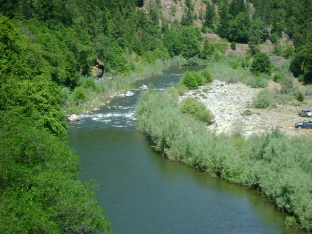
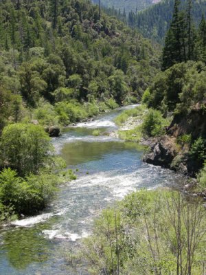
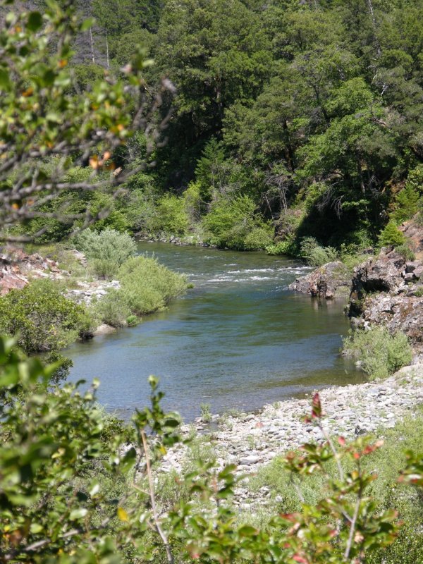
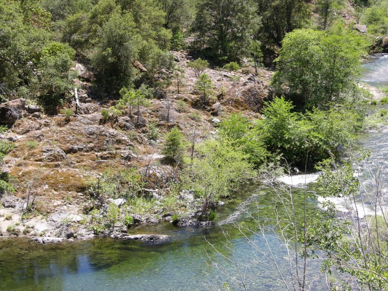
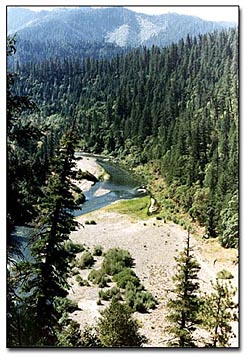
westerly, then southerly direction, entering a narrower canyon beyond the western edge of town. Due to small human population in the area, the river abounds in wildlife. California Black Bear, mountain lion, Pacific Fisher, elk, blacktail deer, otter, raccoons, skunks, fox, coyote, and steelhead and salmon fish are among those most often seen. Blue heron, ducks, geese, owls, hawks, osprey, and eagles are just some of the many birds frequently seen in and around the river.

People utilize the river for recreation in many ways. Anglers count it among the great steelhead and salmon fishing rivers of the west. It is fished from shore and from drift boats. In 1994, salmon numbers were up dramatically from the previous few years, indicating that the salmon will continue to increase, perhaps due to new safety measures.

Rafting and kayaking parties of a few hours up to several days are numerous during the days of summer months, as they traverse placid areas mixed with rapids rated high enough to challenge the most daring. Rafters come from all areas of the United States to meet the challenge of the river, yet novices can have an exciting, but perfectly safe outing of several days duration. Rapids of all classes are found on this section of the Klamath. Guide books and guide services are locally available for information and trips.

Small-scale gold miners of all ages, backgrounds, and skill levels are often seen during spring and summer, as the river gives up just a small portion of her rich bounty of gold each season. Many are retired or semi-retired people seeking a rewarding pastime that is physically active. Others are families looking for an activity they can all participate in and enjoy in the great outdoors that is healthy, active, and fun! Up to $300,000 per year in placer gold is sold in the area, and gold prospectors come from as far away as Germany and Sweden in an attempt to wrest the golden treasure from these waters.

INDIAN CREEK

Indian Creek flows into the Klamath River in Happy Camp, and as it rushes down from its headwaters in the Siskiyou Mountains to the north, it provides a beautiful setting for camping, fishing, rockhounding and gold prospecting. Indian Creek’s south fork has a rich deposit of a local “jadeite”, or jade-type rock known worldwide as “Happy Camp Jade” that is much prized by rockhounds and jewelers. While the mine is privately owned, pieces of jade in many shades from palest green to almost black are commonly found in Indian Creek, and in the Klamath River. Especially prized are pieces with veins of gold running through. Garnets are also abundant in the pebbles of Indian Creek and the river. Numerous U.S. Forest Service River Accesses on Indian Creek afford lovely, quiet picnic areas, where wildlife, birdlife, and abundant wildflowers abound in spring and summer months. Twelve miles north of Happy Camp, West Branch Indian Creek Campground (a U.S. Forest Service facility) provides a lovely, quiet camping area on the west branch.

ELK CREEK

Elk Creek flows into the Klamath River from the south, about 1/2 mile west of town. This creek furnishes drinking water for the community, and abundant fish life for anglers. Somewhat more difficult to access, as the canyon is steeper, Elk Creek offers its own unique opportunities for recreation. At its confluence with the Klamath, and just below 5-mile bridge are swimming holes frequented in summer, where the water is always cool (you’ll need to check that you’re not on private property, however). Cool and shady during summer months, Elk Creek Campground, a private campground, is just a little way up the road from town and has all facilities for campers. Sulphur Springs Campground, a U.S. Forest Service Day Use area 13 miles up Elk Creek road provides a most serene and beautiful setting for picnicking, with barbecues and tables. 
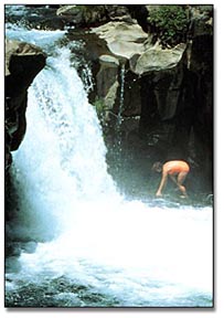
Rock-lined walks, in use for many, many years, lead you along the banks of the creek to wander under the trees. Sulphur Springs itself offers a warm, healing, sulphurous bath at the edge of Elk Creek, any time of year. Just above the campground is a lovely waterfall and grotto for swimming. This area was in use by the Karuk Indians, long before being settled by any white man. Just two miles above the campground the road is closed to motor vehicles, and this area, a former elk preserve is now rich in elk.

KELLY LAKE

Located north of Happy Camp in the Siskiyou mountains, Kelly Lake provides trout fishing for residents and vacationers, alike.

PACIFIC CREST TRAIL

The idea for this trail was conceived in the 1930’s, and it is now a horseback and hiking trail that extends from Mexico to Canada. Crossing the Klamath River at Seiad Valley, just 18 miles east of Happy Camp, the trail can be accessed and hiked north to the Oregon border and beyond, or south to Castle Crags, below Mount Shasta.

ARCHERY/HUNTING

Happy Camp has an active Archery Club to provide enthusiasts with sport, and novices with instruction. During deer and bear hunting seasons, the archery hunting seasons are just as enthusiastically greeted by residents as the rifle hunting seasons. A very popular hunting area, local mountains provide excellent hunting for all species, in season.

GOLFING

Upriver from Happy Camp about 45 miles, in the small community of Klamath River, the Eagle’s Nest Golf Course borders the river, and provides a 9-hole golf course for the golf enthusiast, open year-round.

HIKING/BACKPACKING

Are at their best in the Happy Camp area. In addition to the Pacific Crest Trail, many other nearby hiking trails, of various degrees of difficulty, are available to hikers. Books outlining these trails, and Forest Service maps, are available locally. In town, the “Happy Camp Trail,” that begins on the far side of the Klamath River bridge, affords an easy hike to spectacular views of the town, the river, and the surrounding mountains.

GUIDE SERVICES

Are available for horseback or llama pack trips into the Marble Mountain Wilderness, or other mountain areas. They are also available for drift boat fishing and rafting, offering a variety of trips to a wide selection of areas on the Klamath River.

GOLD PROSPECTING

The Siskiyou Mountains carry large deposits of gold, and in addition to the Klamath River, Indian Creek, Elk Creek, and Thompson Creek all have gold deposits, as do many other creeks flowing
into the Klamath River. Most of the creeks, however, have deep bedrock, and do not carry as much gold in the overburden as does the Klamath River. What this means to the casual, or novice gold panner is that one is more likely to find gold while panning on the river than on the creeks. Gold is generally easier to locate in this area than in most other areas of California, due to the easy access, the size of the river–which maintains shallow gold that is easy for the smallest-scale or beginning prospector to find, and, due to the remoteness of the area, it has not been worked nearly as heavily as other areas of the state. Many locations in this area are under legal claim, however, and it’s important not to pan on someone’s claim. Information on open areas, or where casual panning can be done is available in Happy Camp from The New 49’ers’. They can also provide instruction, if needed. Workshops are held during late spring and summer months.


BIKING

In the Happy Camp area is on the increase in recent years with the development of mountain bikes, and with the formation of clubs which are looking for biking challenges. Often seen on the Klamath River Highway in summer months, the road offers challenges to the bikers, and the continuing development of biking trails will accommodate these increasing numbers.

WINTER SPORTS

Are also to be found in the area. Just 25 miles north of the town on Indian Creek Road, the “Sno-Park” offers opportunities for snowmobiling and cross-country skiing. Downhill skiing is available at Mt. Ashland, to the north on I-5 just into Oregon, and at Mount Shasta, both popular ski resort areas. At the present time, the Sno-Park is not directly accessible by auto in the winter months. The road is not cleared on this side of the mountain.

PARKS

Are available within the confines of the community. Gail Zink Memorial Park, next to the Happy Camp Elementary School, is maintained by the Happy Camp Community Services District (HCCSD), and offers a beautiful grassy area, tables and barbecues. The Happy Camp Community Park, just down the hill, also under the auspices of HCCSD, now offers a lovely setting for group outings. Situated at the river’s edge, it includes ponds, shade trees, restrooms, a new park pavilion for dances and concerts, and grassy reas. Playground equipment is in the development stage. Development of a new “mini-park” in Happy Camp’s “Old Town” is underway.

While Happy Camp cannot offer crowds, 
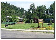
streetlights, long waiting lines, or a large populace, its setting among magnificent natural resources and the unhurried pace of life are just compensation for those who choose to live here. Here the air is sweeter; a unique microclimate allows residents to grow more varieties of plants than can be found most anywhere else; the natural beauty and serenity of the area are unmatched in the hurried pace of life that rushes past across the mountains in every direction, leaving this community to provide a unique opportunity to raise a family, live out your “golden years,” or have a unique vacation in “God’s country,” almost untouched by the rest of the world.


Happy Camp
Small-scale Gold Prospecting
Capital of the World

by Marcie Stumpf/Foley

Mining has played a major role in Happy Camp, California ever since its establishment in 1851. 
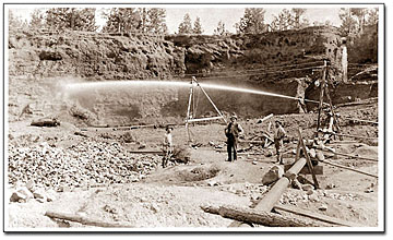
Local people tell of families who earned a living during the lean years of the depression by mining and, as recently as 1986, an active local major gold mine, the Noranda mine, closed after producing hundreds of thousands of ounces of gold. In the last few years, small-scale gold prospecting has increased in the area, as people travel from all over the world to seek Happy Camp’s rich gold deposits.

Today, Happy Camp is just about the same size as it always was, and is just about as rural as you can get in the state of California. It has the distinction of being too far away from anywhere to be able to commute, and local industry is extremely limited.

Happy Camp is very near the Oregon border, nestled in the heart of the Klamath River Canyon, on Highway 96. It is approximately 74 miles west of Yreka and Interstate 5, and is approximately 138 miles northeast of the town of Eureka on the coast. To the north are the peaks of the Siskiyou Mountains, with Grants Pass, Oregon about 70 miles distant, and to the south lie the peaks of the Marble Mountain Wilderness and the Trinity Mountains.

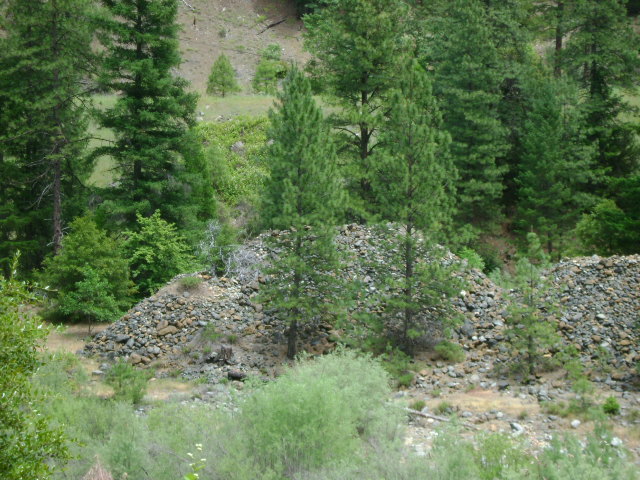
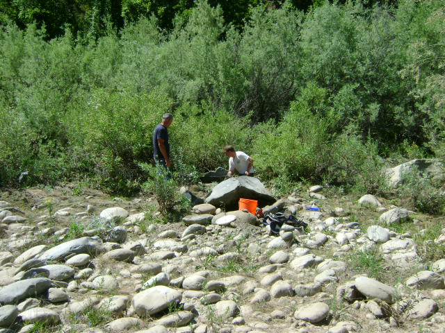
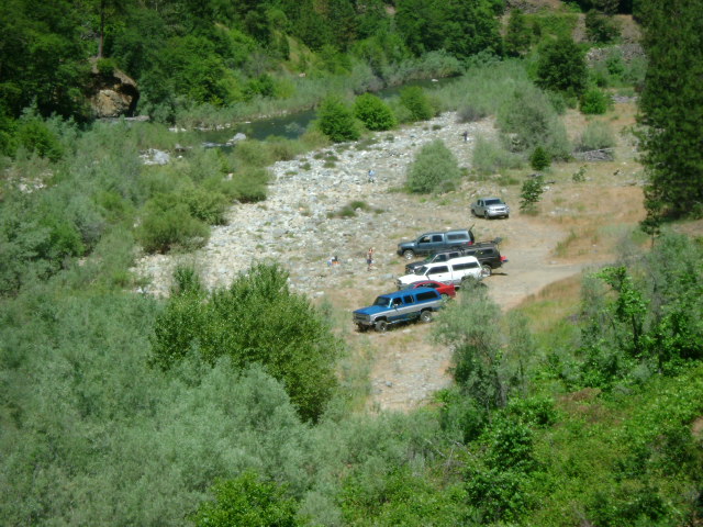
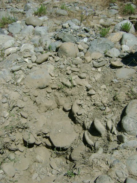
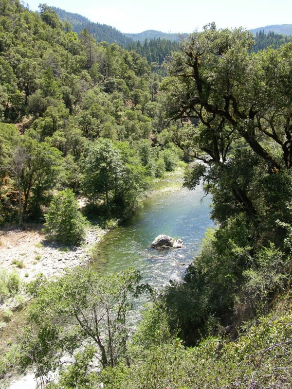
For those interested in small-scale gold prospecting and mining, this secluded setting is perfect. Not as close or accessible as mining areas in the Mother Lode, this area has not been as heavily worked. It is also an area where gold deposits are laid down in flood times in the many gravel bars, in layers—sometimes in a layer only a foot, or 18 inches below the surface of the material. Many of these gold deposits are very accessible, and have proven to be quite rewarding for people working with gold pans, sluices and motorized sluicing gear. These types of mining, besides dredging, are done all along the Klamath River from I-5 to many miles below the town of Happy Camp.

Dredging is accomplished with all sizes of dredges, up to eight inches. Although the Klamath is a fairly large river, there are many sections which have shallow bedrock areas, suitable for working with very small dredges. Another feature that dredgers particularly like is the fact that below the confluence with the Scott River, located about 45 miles upriver from Happy Camp, dredging is open all year long.

Many of the tributary streams in this area are gold bearing. Most have some gold dredging activity. They generally contain beautiful nugget gold, but most require boulder-moving equipment, and the gold deposits are usually contained in scattered pockets.

One of the newer methods of mining that is enjoying recent success in this area is electronic prospecting; or hunting for gold nuggets with a metal detector. Recent advances made in nugget detectors, which allow them to function more efficiently in heavily mineralized soil, have opened up an entirely new dimension for exploration.

Mining is not the only activity for vacationers in this area, and many families come here to enjoy an all-around vacation. River rafting is very popular, and there are several companies who provide trips lasting anywhere from a few hours, to several days, including gourmet cooking, and excellent experienced guides. Pack trips into the neighboring wilderness area are offered, and can provide an unforgettable experience for anyone seeking the natural beauty and serenity of the high mountain areas.

The Klamath River is a well-known area for its fishing, and fishermen are common all along the river. You can fish on your own for steelhead and salmon, or take advantage of professional guides who provide drift boat trips, and can even furnish all necessary equipment. Trout fishing is popular in the nearby streams and lakes, with Kelly Lake providing some of the best sport.

Happy Camp has stores that can provide almost all necessities. There are several motels, and both private and U.S. Forest Service campgrounds, all of whom provide comfortable and reasonably priced lodgings. You won’t find a McDonald’s, but there is a hamburger stand, and a pizza place. In addition, there are two restaurants, both providing good home-style cooking.

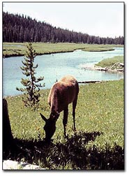
Happy Camp is not a glitzy, tourist trap town by any means. There are people here who actually make a living by mining for gold.

For those interested in rockhounding, Happy Camp is world famous for its jade, and has an actual working Jade mine. It is also known for the local deposits of gem-grade rhodonite. Garnets, platinum, and pyrites are also often panned-out, along with gold. Round, smooth jade pieces are commonly found along the riverbanks in the shallows, in a very wide variety of colors. Large sapphires have also been found locally, and the old-timers even found some diamonds!

As you can see, the area has much to offer, so whether planning your vacation or just a short outing, this is definitely an area you may want to try. The people are friendly, the gold is great, and the fun and relaxation offers something for the whole family.


By James Bruner

Travelers find new friends, the beauty of nature, and the excitement of gold in northern California.

The road stretched endlessly before us. Familiar hills of Arkansas and Oklahoma now lay far behind. The miles slipped steadily by as we drove hour after hour across the Texas plain, but we knew we were only getting started. We were on a prospecting and treasure hunting expedition that would require traveling almost 5,000 miles, and spending many nights in camp before we would again see the comforts of home. Still, I couldn’t help thinking how much easier it was for us than for those first 49’ers who traveled this same route by wagon and horseback in their quest for gold.

Our purpose for this trip was really three-fold. My treasure hunting buddy, Jay Gill, and I had planned for months to make a gold prospecting trip to northern California. I also wanted to visit with my father while we were there. He is now in his 80’s, but acts like he thinks he’s still a teenager.

The third purpose, which came up after our trip was already planned, concerned my son, Monty. He had won an academic scholarship from a laboratory in Richland, Washington. He would be paid for working in the lab and earn a semester of college credit at the same time. The deal was just too good for him to pass up. And I promised his mother that I would see him reach Richland safely. This would mean driving a few hundred more miles than originally planned, but what the heck, we were on vacation anyway.

I have been a treasure hunter for almost 40 years and have been very active in just about every phase of the hobby/profession. But when it comes to prospecting for gold, I consider myself strictly a greenhorn. The only actual prospecting experience I have had previously took place over 30 years ago when I spent a few months in the Sierra near Twain Harte, California. Fortunately my partner, Jay Gill, was a seasoned old veteran. He has prospected in many different places over the years, including the Colorado Rockies, and even in the jungles of Ecuador. I was depending on him to teach me the ropes and get us off to a good start.

We reached Gallup, New Mexico long after my usual bedtime and stopped to grab a few hours sleep. As a spectacular desert sunrise silhouetted craggy hills in the East, we headed north on Highway 666. This route took us through the eerie lunar terrain where Shiprock and skeletal remains of other long dead volcanos dominate the landscape. Jay and I had traveled this way on another treasure hunting trip back in the spring. But, Monty had never seen anything like it and was really impressed with the spectacular scenery.

We soon passed through the south-west corner of Colorado and on through the beautiful canyon country of Utah. By the time we had grown too sleepy to drive any farther we were in the Snake River country of Idaho, where we stopped for the night. We crossed the Snake River Plain early the next orning, along the old Emigrant Road used so many years ago by those early pioneers headed for Oregon.

Again my mind drifted back, as I tried to visualize what it would be like to traverse this harsh terrain day after day on foot or in a wagon. This was only our third day on the road, and already I was becoming weary. But how could I really understand the feelings or taste the hardships of those hardy souls who had to endure months of hot, dusty travel, while we crossed the same distances in mere days of air conditioned comfort.

We reached Richland, Washington in the afternoon and got Monty moved into his new apartment. Jay and I spent the night with him and got some much needed rest. With a bit of sadness I said my goodbyes to Monty early the next morning, knowing it would be several months before I would see him again. But he was in good spirits and looking forward to a new experience.

As Jay and I drove south across Oregon in view of beautiful snow-capped mountains, the spirit of adventure gradually returned to me also. We reached Tulelake, California, where my father lives, that afternoon. After visiting a while, Jay and I decided to see what the coinshooting was like here in northern California. The Silver Sabre II I was using, and the Tesoro Toltec 100 Jay had brought, performed quite well. By dark we had dug a little silver and a large number of modern coins. But it was gold that we had traveled thousands of miles to find, and we were anxious to reach the Klamath River and do some serious prospecting.

Early Sunday morning Jay and I headed west on Highway 161 which runs along the state line just inside the northern border of California. As we drove through a waterfowl refuge on Lower Klamath Lake we noticed a road sign which stated “SLOW DUCK CROSSING.” This was the first time I had ever seen a “duck crossing” sign, but it was no joke. We had to slow down and even stop at times as thousands of ducks crossed the road, some flying and some walking. It was a sight to thrill anyone who loves to view wildlife in their natural habitat.

We checked our old road atlas and considered taking a shortcut over the mountain on a Forest Service road, even though it wasn’t shown on the new highway map we had. We stopped at a ranger station to check on the situation before turning off the highway, but the station was closed. We decided to take the short-cut anyway since it would save us about 50 miles of driving, and after all, Jay and I were no strangers to back country roads.

Most of this road was dirt or gravel, and after reaching the top of the mountain side roads branched off in all directions. Few of the intersections were marked and it was difficult to tell which way we should go. At one junction we chose the wrong fork of the road and soon found ourselves at a dead end near the bottom of a canyon. It was bow hunting season in the area and we met a deer hunter who gave us directions on how to get down the mountain to the semi-ghost town of Montague. We made it this time without getting lost again.

Even though we had been side-tracked for a time, the drive over the mountain was one of the most interesting parts of the trip. Wildlife was more plentiful here than on any other stretch of road we had traveled. Chipmunks and various species of birds were everywhere. We saw numerous black-tail deer and took some good pictures of them. The scenic views were also spectacular, with snow-capped Mt. Shasta rising in the background.

We arrived at Happy Camp in mid-afternoon and stopped at the New 49’ers headquarters to get information on where to camp and pan for gold. The first person we met was Dave McCracken. Dave was in the process of giving a seminar on placer gold recovery methods. Not knowing what was going on, Jay and I had barged inside right in the middle of his seminar, as if we owned the place. Dave was very gracious about the whole thing, and after a brief conversation and introductions all around, we sat in on the rest of the seminar.

After the seminar (which proved to be very informative), we talked a while longer and Dave told us we could spend the week as his guests and work New 49er Club claims. Bill Stumpf, the organization tour guide, directed us to a campsite for the night on Elk Creek Road just south of Happy Camp. We quickly set up camp and started panning on the nearby gravel bar. I recovered several flakes of gold from the first pan full of material, and this continued to be the case with every pan the entire week we were on the Klamath.

The next day Bill led us several miles upriver and showed us where we could camp and pan for gold. He even 
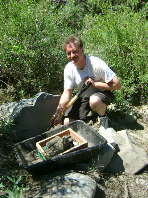
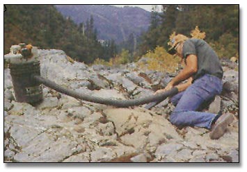
loaned us his MACK-VACK to use while we were there! The MACK-VACK is a vacuum type tool for sucking dirt and gold out of cracks and crevices and into a five-gallon bucket. It proved to be very effective and we used it to good advantage in several locations. After showing us around and pointing out a few spots he thought should be productive, Bill wished us luck and went on his way.

We set up camp near two other miners who were working with high banking units. One of the miners was named Don who said he lived in Klamath Falls, Oregon. He worked for the railroad and mined gold during his vacations and days off. Don was a very outgoing person who tried to be friendly and helpful from the very first meeting. Don also hunts nuggets with a detector and had some nice specimens to prove it. The other miner was Jerry Snell from Eugene, Oregon, and he works for a timber company. Jerry is more reserved and waits until he has time to evaluate a person before committing himself. But after he gets to know someone and finds out that they are O.K. he will help them any way he can. Jerry showed me a nice collection of gold he had recovered from his high banking operation on the Klamath.

A large black bear visited our camp every night, but he didn’t disturb anything. He would just leave his spoor and then walk on up the river. He was probably checking out every miner’s camp along the way to see what they were up to. After all, this was HIS territory and we were just trespassers. If I had met the old boy on the trail there wouldn’t have been any question about who had the right of way. Don and Jerry said they had seen him walking along the river about 50 yards from camp the evening before we arrived. He remained out of sight the few days we were there. But just knowing he was around added a lot of atmosphere and a sense of wildness to the country.

Our side of the river had been heavily worked, both by the early miners and in recent times. Jay and I looked the situation over and decided that with the limited equipment we had, our best bet would be to clean out overlooked crevices and pockets between the large boulders along the river. We had brought along a sluice box, but the river was so deep and swift along this stretch that we didn’t find a suitable place to set it up until the last afternoon we were there. By that time it was too late to pack our equipment the half-mile upriver to that location. So, we panned all the material by hand and recovered what gold we could that way.

Gold panning was something I wasn’t very proficient at and I needed a lot of practice. After a couple of days of steady work I became a lot better at it. But I was never able to work a pan of material as quickly as Jay could. As I watched the sand and gravel swirling around in my gold pan I tried repeatedly to let my mind drift back in time and try to recapture the atmosphere of those early miners who first worked this river. Although the scenery was still wild and beautiful, and my muscles ached from the unaccustomed effort, the feeling I sought continued to elude me. Perhaps the sound of gasoline engines on the high bankers and the occasional airplane overhead held me too close to the present.

After we had been panning a couple of days, Bill Stumpf and Gordon Zahara came by to see how we were doing. Gordon has been very successful nugget shooting with a detector in some of the old hydraulic mining areas nearby. The New 49ers contracts with Gordon to help members and guests become more proficient at nugget hunting and to guide expeditions into the field several days each week. I expressed an interest in some nugget shooting with the Tesoro Silver Sabre II I had brought along on the trip. I knew the Silver Sabre II wasn’t specifically designed for finding gold nuggets, but I thought it would be sensitive enough to do an adequate job. Gordon said he would be glad to take us on a nugget shoot, and we made plans to go the next day.

As luck would have it, it was showering heavily the morning of our planned hunt. We met Gordon at the New 49’ers headquarters and discussed the situation over coffee. After watching the rain for a while we decided to cover our detectors with plastic bags and try it anyway. The clouds began to break up before noon and it turned into a nice day. Another man and his two teen-age sons accompanied us on the hunt, but they only stayed until about noon.

We drove to a spot near the little mining town of Clear Creek, then Gordon led us up the mountainside along a steep trail about a quarter mile to an old hydraulic mining site. The biggest problem we encountered detecting the area was the highly mineralized ground in certain areas and the many hot rocks. The man and the two teen-age boys were not familiar with the new “nugget shooting” detectors they had recently bought and soon became very frustrated trying to deal with the numerous hot rocks and ground mineralization. I think that is the main reason they gave up the search so early. I could hardly keep from laughing when I overheard the man tell Gordon, “We’re having a problem chasing elusive signals.”

Gordon is a veritable storehouse of knowledge concerning the gold mining potential of the area and the use of detectors in its recovery. He was more than willing to share that information with anyone who was interested and wanted to hunt. Of course he has his own special places he isn’t ready to take anyone else to, yet. One of the methods we used in our search was to rake down the steep sides of a shale bank and go over it with our detectors. Gordon was the only one who found a nugget that day, a small one about the size of a rice grain.

We tested the Silver Sabre II on this small nugget and it detected it easily. I also had no difficulty detecting small hot rocks and galena crystals, which seemed to have about the same conductivity as a gold nugget. I believe I would have found a nugget with the Silver Sabre II if I had just been fortunate enough to have gotten over one. There is an old mine shaft near the area we were detecting and a trash dump from that time period. Jay and I hunted a while in that area and found several interesting old relics from the early mining days.

Another impressive feature of the Klamath River country is the many different kinds of rocks and minerals found there. We often found small garnets along with the flakes of gold and black sand at the bottom of our pans. We also picked up a couple of nice pieces of jade and several other interesting rock samples. I believe this would be a prime area to do some rock hounding if a person could get this mind off gold mining long enough.

The days passed quickly and before we realized it the time had come when we needed to pack up and start home. Jay is a fireman and had to report back to work the following week. We returned the borrowed MACK-VACK to Bill Stumpf and said our farewells. We were very grateful for the generous hospitality everyone had shown us. I wished to show my appreciation by giving Bill and Marcie and Gordon’s wife a few Indian spear points from Oklahoma and Texas. Bill wasn’t to be outdone, however, and before we left he handed me a beautiful gold nugget as a souvenir. By Saturday afternoon we were driving across the lonely Nevada deserts on our way home.

The road stretched endlessly before us. Although we had traveled thousands of miles within the last few days, none seemed as desolate as this barren desert. I guess the last couple of weeks of strenuous effort and long days on the road had taken its toll. I had been trying the entire trip to go back in time and experience the feelings of those early pioneers and miners. Now, crossing the empty deserts of Nevada, almost totally exhausted, I was at least partially successful. It didn’t matter that we were traveling at 65 miles an hour. The horizons were so distant there was no perception of getting anywhere. We had somehow become caught in a realm where time was meaningless and the vastness of the land too great to comprehend. The chances of us ever reaching our homes began to seem hopeless.

Yes, I had finally recaptured the feeling some of those early travelers must have experienced, but it wasn’t exactly what I had expected. In an effort to come back to reality, I turned to Jay and said, “It may not seem like it now, as tired as we are, but someday we’ll look back at all this and think of it as a big adventure.” Jay sat in silence for several moments as if contemplating the events of the past few days. “It has been quite an adventure”, he answered softly.


By Dave McCracken

Using the Le Trap Sluice to make your
final clean-up go faster.

Dave Mack

Because we have so many innovative, active gold dredgers and small-scale miners on the Klamath River, I don’t recall exactly who came up with the original idea of using a Le’ Trap sluice for final cleanup. When I first heard of it, I had reservations. We have been improving the fine gold recovery on our dredges for years. I was afraid the plastic sluice in final cleanup would lose a large percentage of the extra-fine gold that we are now recovering in our dredges. However, upon close inspection, this proved not to be the case.

One of the most time consuming jobs on any serious gold dredging activity is the final cleanup procedure of separating your gold from all of the other heavy black sands and materials which are also recovered by the dredge. My personal operation is utilizing two eight-inch dredges. We are working in an extensive fine-gold paystreak, which requires us to cleanup about two-thirds of our recovery systems at the end of each day. This amounts to about three five-gallon buckets of concentrates to process. In the past, we have utilized spiral wheels and just about every other kind of cleanup device available to process our final concentrates down to our final gold product. Always, with any of these devises, we succeeded in reducing the amount of concentrates down to about a handful, which we would then process with mercury amalgamation.

During the last several years, we have been using a professional shaker table to work our concentrates down. We found that the shaker table was faster than spiral wheels and the other devises we had tried. Even so, with three five-gallon buckets to process, we were spending several hours each day just running our concentrates across the table. Once the concentrates are worked down to a handful-sized amount, the final amalgamation process only takes about a half hour. In other words, the most time consuming job had been to work the concentrates down to just a small amount.

Shortly after we heard that the Le’ Trap sluice was being successfully used, there were other dredgers on the Klamath, dredgers who knew what they were talking about, starting to rave about how fast and effective the sluice was for final cleanup. Lots of people were starting to use the new system. Consequently, we decided to give it a try. We were quite impressed with the results!

Basically, the system is quite easy, and also quite inexpensive. The Le’ Trap sluice retails at about $90. When used in conjunction with a dredge, no further equipment or pumps, etc., are needed, except a garden trowel of some kind to shovel concentrates with.

We start our dredge and run it just over idle speed to get a small amount of water moving through the primary dredge sluicebox. Water flow through the Le’ Trap sluice can be adjusted by engine speed, or by placing any flat objects under the tail end of the sluice. If you do not have enough water flow, you will notice the black sand does not move through the sluice with any regularity. Rather, it tends to pack up and bury the riffles. In this case, you will notice your gold sitting on top of the black sand, rather than inside the riffles.

If you have too much water flow, you will notice that the black sand flies through the box, with little chance to make contact with the riffles. There is plenty of margin for error. Ideally, with the proper water flow, as you feed concentrates into the sluice with a garden trowel, you will watch the black sands work their way down the box in an orderly procession. The flat, smooth section of the box ahead of the riffles allows the pieces of gold to trail along just behind the black sands. And the riffles stay somewhat clean and open. You can watch the flakes of gold wash down and drop into them.

When done properly, you will find 90% of your gold trapped behind the first four or five riffles. A few pieces, just a few, will work their way further down. But, almost none make it all the way out of the Le’ Trap sluice. We were working with several ounces of very fine gold per day; and to test the system, several times we brought all of the tailings home to see what we had lost from the Le’ Trap 
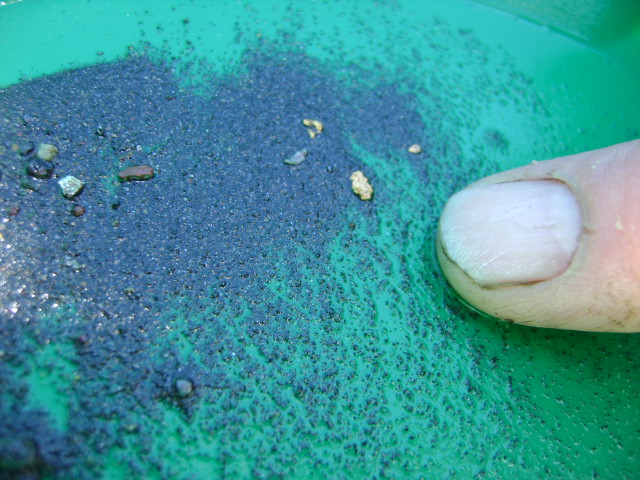
Sluice. It was never more than a half of one percent of our total gold recovery.

And, really, we didn’t even lose that gold, because it simply ran back into our dredge recovery system.

The Le’ Trap sluice is a one-piece molded unit which has a unique set of very efficient short riffles which seem to suck the gold right out of the water’s current. Cleanup of the sluice is simply a matter of tilting it up and dumping it into a tub or gold pan. The final product ends up not being much more than a handful of gold and your heaviest concentrates. Needless to say, this is much easier to deal with, rather than having to lug several heavy buckets of concentrates up the hill to our vehicles!

The main ingredient that we saved with this new cleanup system is time. We were able to feed the Le’ Trap sluice about twice as fast as our commercial shaker table. And, we only needed to screen the concentrates down through a quarter-inch screen using the Le’ Trap sluice, rather than through a quarter-inch mesh screen, then an eighth-inch screen, and then a 20 mesh screen to use the shaker table. This saved a lot of time in itself.

Plus, the system was so simple to use, we purchased a second sluice and used one on each dredge to cut our cleanup time in half again!

Since it only takes one person to feed the Le’ Trap sluice, we would put everyone else to work with end-of-the-day organizational activities while the concentrates were being run. Things like putting airlines and weight belts away, transferring used gas cans off the dredges, minor equipment repairs, etc. About the time that everything is put away and finished for the day, the concentrates are also finished, and we only have a half-hour of finish-up when we get home. This is a HUGE improvement over our old systems for final cleanup.

While smaller dredges have lesser amounts of concentrates to deal with at the end of the day, the time it takes to work them down usually is considerable, even on a three-inch dredge operation. That is, providing you are recovering worthwhile amounts of gold, especially fine gold. I don’t see any reason why the Le’ Trap sluice could not benefit any dredging operation where the dredge sluice is wide enough to allow the Le’ Trap box to fit inside.

We will be using this system in our operations during this upcoming season, and in future seasons until someone comes up with something better and faster. Anyone want to buy a good commercial shaker table?

 
video subscription graphic
This story first appeared in Gold & Treasure Hunter Magazine May/Jun, 1992 on Page 36.
This issue is still available! Click here.

By Dave McCracken

Experienced gold miner lays out fundamentals of running a successful surface prospecting program.


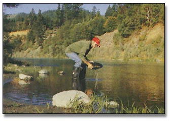
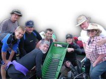
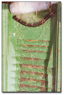
A “sluice box” is a trough-like gold recovering device which has a series of obstructions or baffles, called “riffles”, along its bottom edge. While a steady stream of water is directed to pass through, streambed material is shoveled into the upper-end of the box. The flow of water washes the streambed materials through the sluice and over the riffles, which trap the gold out of the material.

The reason a sluice box works is that gold is extremely heavy and will work its way quickly down to the bottom of the materials being washed through the box. The gold then drops behind the riffles and remains there, because there is not enough water force behind the riffles to sweep the gold out into the main force of water again.

A sluicing operation, when set up properly, can process the gold out of streambed material about as fast as it can be shoveled into the box. This can be many times more material than a panning operation can handle, yet with similar efficiency in gold recovery. How much material can be shoveled into a sluice box greatly depends upon the consistency and hardness of the material within the streambed itself, and how easily it can be broken away.

A sluice requires a steady flow of water through the box to operate at its best efficiency. Most often, the box is placed in a stream or creek where water is moving rather swiftly, with the sluice being placed in such a way that a stream of water is directed through the box.

In locations where water is available, but is not moving fast enough to be channeled through the box for sluicing purposes, the water can be pumped or siphoned to the box with excellent results (covered later). How much water is available, and whether or not it will need to be transported to your sluice box, is something that needs to be considered during the planning stages of a sluicing operation.

Because so much more material can be processed with a sluice, than with a gold pan, streambed materials which contain far less gold values can be mined while recovering just as much or more gold. Therefore, if the streambed material had to pay a certain amount in gold values in to be worked with a gold pan to your satisfaction, gravel containing only a fraction of as many values can be worked with the same result using a sluice box. This is an important factor to grasp; because it means the modern sluice box opens up a tremendous amount of ground that can be profitably mined by an individual.

Motorized sluicing (also often called “high-banking”) is an activity similar to sluicing, except that sluicing is almost always accomplished with the water-flow from the creek or river keeping gravel moving through and over the riffles. As demonstrated in the following video sequence, a motorized sluice (also called a “hydraulic concentrator”) is usually set up with a water pump that supplies water for the sluice box:

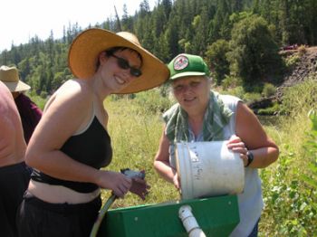
Motorized sluices are usually equipped with a recovery system that is set up with adjustable-length legs. This allows the box to be adjusted from side to side and front to back on uneven ground. This allows the water flow to be created for optimum gold recovery. Most motorized sluices available on today’s market also include a screening device over the top of the feed-section of the sluice box. Screening the larger-sized rocks out of material to be sluiced is one of the primary methods for improving fine (small) gold recovery. Any time you can screen larger rocks out, you can slow the water down through the sluice, which will allow even smaller particles of gold to become trapped inside the riffles.

In normal sluicing, the operators must find a location alongside of a creek or river where the water is flowing just right, at the proper depth, to set up the sluice so the proper amount of water can be directed through. Once the sluice is set up, gold-bearing material must be carried to the sluice, screened separately, and carefully fed through the sluice box.

With a motorized sluice, all you need is a supply of water within several hundred feet of where you want to dig. The screen and sluice assembly can be set up directly at the work site so that pay-dirt can be shoveled directly onto the screening section. The pump/engine assembly will pump water from the water source, through a pressure hose, to the sluice.

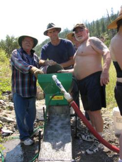
Another advantage to the motorized sluice is that in some areas today, it is not legal to wash silt directly from the bank into an active waterway. With a motorized sluice set up some distance from the stream or river, you have an opportunity to utilize natural contours up on the land to slow the water down enough to allow the sediments to settle before (if ever) the water re-enters the creek or river.

SAMPLING

Just like in any other type of gold mining activity, the key to doing well is in digging sample holes to first find a high-grade gold deposit.

Placer Geology

In many places, there is more gold up on the banks than you will find in the river. This can sometimes be true on the Klamath River in northern California. Actually, it is not only that there is more gold on the banks than in the river. The gold on the banks can sometimes just be easier to get at for a small operation.

What happened along the Klamath River, and in many other areas, is not difficult to understand. The old-timers started mining down in the creek or river, and moved uphill, allowing gravity to carry the water and tailings back down towards the creek or river. As the old-timers worked further up into the banks, often the gravel became deeper and more difficult to remove by conventional hand methods. In time, the old-timers developed hydraulic mining. This is where they directed large volumes of water from nearby (or sometimes distant) creeks under great pressure through monitors (huge pressure nozzles). The high-pressure water was used to wash large volumes of gravel through large sluice boxes placed on the banks of the creeks and rivers. As the sluicing operations cut further up into the banks, the sluice boxes were moved forward, which left tailings deposited on the banks.

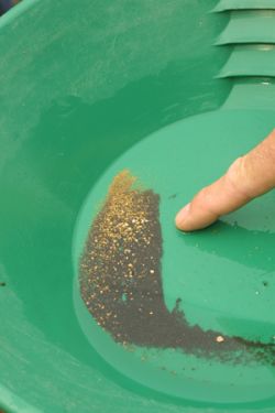
It is estimated that as much as 50-percent of the gold washed right through the sluice boxes in hydraulic operations because of the large volume and velocity of water which such operations used. Hydraulic operations did not lose gold in the same amounts all of the time. Much of the gravel that these operations processed contained little or no gold. The concentrations of gold were found along bedrock or at the bottom of lower strata flood layers. So, valueless top-gravels were processed at volume speed, and they would try to slow down when getting into pay-dirt materials. Sometimes, however, they would cut into pay-dirt materials at volume speed–before having a chance to slow down. This is where large volumes of gold would wash directly into the tailing piles.

Since the time of large-scale hydraulic mining, there have been several occasions of extreme high water. The 1964 flood in the western United States is one example. Floods of such magnitude, all throughout gold country, re-deposited old hydraulic tailings piles into newly-formed streambeds up on the banks and within the active waterways. Places where gold was lost from hydraulic operations formed into new pay-streaks–often only inches or a few feet from the surface. This is true all up and down the banks of the Klamath River–and probably many other rivers as well–which has created a wonderful and exciting opportunity for modern small-scale gold miners.

Contrary to popular belief, many pay-streaks today are not found down along the bedrock. In fact, many of the pay-streaks surface miners are finding along the Klamath River are situated in a flood layer (1964 flood) within two feet of the surface. This flood layer is often resting directly on top of undisturbed hydraulic tailings.

We are also finding similar pay-streak deposits inside the active river with the use of suction dredges.

Finding pay-streaks with a surface digging project is usually done by setting up the sluice in several different locations, and giving each sample a large enough test hole to obtain an idea of how much gold the gravel is carrying. Sample holes should be taken to bedrock if possible. However, if the gravel goes deep, you have to avoid getting in too far “over your head.” At the point where you start digging deeper than 3 or 4 feet with a pick and shovel, any pay-streak is going to have to be exceptionally rich to make the effort worthwhile. Richer deposits are more scarce; and therefore more difficult to find. So it is important to stay within effective digging/sampling range, and not get yourself into a full-scale production operation before you have found a high-grade gold deposit.

Sometimes you can learn valuable information before you start sampling. If other miners in the immediate area are finding gold deposits along a specific flood layer, you should be sampling for gold along the same flood layer while digging around in the nearby vicinity. Gathering information such as this is one of the many benefits of belonging to an active mining club or association. Active mining organizations will include others who are actively pursuing the same type of mining activity that you are engaged in.

While sampling with a pick and shovel, it is very seldom that you will actually see gold in the gravel as it is being uncovered. Usually, you do

not see the gold until it is time to clean-upthe sluice box after the sample is complete.

If you finish a sample hole and end up with a good showing of gold, the next step is to find out exactly where the gold came from. In other words, did it come off the bedrock, or did it come from a particular layer in the streambed? You must know where the gold is coming from to evaluate the value of the pay-streak. For example, digging two feet into a paying flood layer requires much less time and effort than digging four feet and having to clean rough bedrock. If you do not know for certain where the gold is coming from, and you assume it is coming from the bedrock underneath four feet of hard-packed streambed, you might decide it is not rich enough to work and walk away from a very rich deposit located at the two-foot flood layer

At the same time, if you are able to reach bedrock, you always want to get a good sample there by thoroughly cleaning the surface and any irregularities there. Sometimes that is where the richest deposits are found.

Pinpointing the source of gold is reasonably easy once the sample hole has been opened up. It is likely that the gold will be concentrated either along the bedrock, along the bottom of a flood layer, or at both locations. Sometimes, there is more than one flood layer that carries gold. You can run small production samples of each stratum separately to see which is paying. Or, sometimes you can simply take pan-samples in the different contact zones between the layers

Some pick & shovel miners are using metal detectors in their prospecting activities. Some of the new gold metal detectors will sound out on pieces of gold as small as the head of a pin! But in gravel deposits, metal detectors can also be used quite well to locate the concentrations of magnetic black sand. Black sand tends to concentrate in pay-streaks, just like gold. Therefore, locations sounding out heavy concentrations of magnetic sand on metal detectors are excellent places to follow up with pick & shovel sampling.

One question commonly asked about sluicing procedure is the proper slope-setting for a sluice box. A sluice box generally requires about an inch drop per each linear foot of sluice. This is just a guideline. Basically, you need enough water velocity to keep the material active in the sluice behind the riffles, but not so much that you are washing most of the material out from behind the riffles. I like to get enough water flow to keep the larger material moving through and out of the box. If I see lots of rocks building up in the sluice, I know I do not have enough water velocity. An occasional rock needing to be helped along is alright in a sluice (although maybe not a dredge sluice!). In surface sluicing (non-dredging), I would rather toss out an occasional rock and have the peace of mind that I am also achieving maximum possible fine gold recovery.

A common practice in sluicing is to also to set up a second sluice behind the primary sluice. The plastic Le’Trap sluice works exceptionally well for this because it recovers fine gold so well, and for its ease in cleanup. The idea is to have a safety check on your primary recovery system to make sure it is working properly.

And if all else fails, you can always do some pan-testing in your tailings to see if your sluice might be losing any gold.

One mistake that beginners often make is in thinking that the recovery system is at fault because they are not recovering very much gold. Most often, however, it is not the recovery system. It is the lack of a good-paying pay-streak! The answer to this is to hustle around with more sampling. Ask around to see what and where it is working well for others in the area. Use their operations as a model.

Flood layer pay-streaks are often easier than bedrock pay-streaks to clean up with pick & shovel surface mining operations. There are several reasons for this. One is that a flood layer pay-streak is closer to the surface. This means less gravel to shovel to reach the gold. Another reason is that it takes more effort to clean the gold off of a bedrock surface when you are not using a dredge. You can only do so much with a shovel. After that, you must resort to a whisk broom and/or a motorized vacuum cleaner. This is why portable dry land dredges are also becoming so popular. They give you the ability to clean bedrock surfaces and cracks with minimum effort. If the gold is coming off bedrock, you must invest the extra effort to clean it off well. Otherwise, you stand the chance of leaving an important portion of the gold behind as you mine forward on the pay-streak.

Many pick & shovel miners today also are equipped with an optional suction attachment. To use it, the pressure hose from the water pump is attached to a suction nozzle that directs the water and material through a suction hose into the sluice. So after an initial hole is dug up out of the water, the hole can be filled with water and material can be sucked into the sluice box. The recovery system can be positioned so that the water discharge can run back into the hole– keeping the hole from running out of water.

So you can dig a hole up on the land, and then begin a suction mining operation outside of the active waterway. This is great!

In California, dredging permits are only required when dredges are operated inside of the active waterway. Therefore, my personal understanding is that suction miners up on the land are not required to have a dredging permit as long as they are not dredging inside the active waterway.

Some surface miners also sample for the gold-path up on the bank by pan sampling the moss. Sometimes, how well the moss is producing gold at the surface can also be an indication of how well the gravel is paying underneath.

When moss, roots, clay and other types of materials are producing good quantities of gold, it is always a good idea to break up the material as much as you can before running it through a sluice box. This is usually done by pulling it apart over the top of a classification screen, or breaking it up inside a bucket of water before running it through the sluice. This slows down production, so the additional work must be rewarded by the recovery of more gold.

Once you find a pay-streak in pick & shovel mining, you want to give some thought to how you are going to develop the deposit with a minimum of wasted effort. For example, you will have to pile the cobbles (rocks too large to pass through your recovery system) and tailings somewhere. Preferably, cobbles and tailings would not be placed upon some other section of the pay-streak. Otherwise they might need to be moved twice, or you might be forced to leave behind high-grade areas that have been further buried. So it is worth some extra sampling to get an idea of the pay-streak’s boundaries. Then you can deposit the tailings material in a location where you will not need to move them again.

Placing tailings is, and always has been, one of the most important aspects of a mining operation–of any size. Yet, it is one of the most neglected aspects of mining by a substantial portion of small-scale miners. In fact, we have a standing principle, true as it may be, along the Klamath River: “Dowsing works: just look where a successful pick & shovel miner or dredger has been throwing his or her cobbles. It is almost guaranteed there will be excellent gold underneath!”

This usually comes back to a simple case of gold fever. The miner starts getting a good showing of gold, gets excited, and never slows down to define the boundaries of the deposit. This almost guarantees an important portion of the deposit will end up underneath cobbles.

Pay-streaks up out of the water are often different from those found in the river or creek. What I mean by this is that they do not always follow the same gold path. When you find a pay-streak in the river, you can usually line it up with the next river bend and make a pretty fair guess where the next several pay-streaks are likely to be. This is because river pay-streaks usually form from gold that has washed down the river along its own gold path during major flood storms.

Pay-streaks outside of the river often were formed from gold out of tailings from old hydraulic mining operations. So you can find a small pay-streak up on the bank, follow it until it plays out, and then not find any sign of it further upstream. This is because the source of the gold deposit was not from a point further up river. Then you can find another pay-streak on another path altogether. In other words, pay-streaks up on the bank might not follow a specific single gold path, as they usually do in the river.

Pick & shovel mining is a lot of fun – when you are finding gold. A healthy portion of our miners along the Klamath River mine out of the water. The reason for this is that it gives them an opportunity to find pay-streaks without having to commit to an underwater dredging operation.

We manage Group Mining Projects just about every other weekend during the spring, summer and fall months in Happy Camp You can find this year’s schedule HERE. You have my personal invitation to come out and get some firsthand experience. We always send participants home with a sample of gold that they help recover–that is, those who go back home. Many join up with us. Watch out–the biggest challenge in gold mining is not in finding the gold; it is getting over the “fever” after you have found it!


Important note concerning Mining & Dredging Seasons on this Property

Google Earth Coordinates: 41 45’10.7″N 123 0’35.0″W

To view the content from the link above you will need to have Google Earth installed on your home computer. Download Google Earth


This property is located about one mile upriver from the mouth of the Scott River. There is an extensive high-banking area there, and there is also a fantastic natural riffle in the river that should provide very productive dredging opportunities. There are also some great camping spots.

You get onto the claim by driving one mile up the Scott River Road from Highway 96. Look for the U.S. Forest Service sign which says “Johnson Bar River Access.” You can follow the access road right down onto the new claim. There is plenty of room for parking and turning around down on the bar.

The downstream boundary sign is posted on a tree where the claim butts up to private property. Private property signs are also posted right there. Our upper boundary is located where the Scott River road crosses the river (bridge).

PROSPECTS: Dredging is going to be wonderful on this claim. When we first began visiting the Klamath River in 1983, there were some local miners dredging directly under the bridge on this same property, and they were recovering pounds and pounds of some of the most beautiful gold we have ever seen. It was big gold; much of it still attached to white quartz, likely from the famous mine just upstream at Scott Bar. To the best of our knowledge, those guys never dropped back to dredge the lower portion of the claim, especially around and beneath the natural riffle (rapids).

We are really lucky to have acquired this property!

There is also a very large bar present which is producing gold for surface miners. While we still have a lot to learn about this new property, initial test results are encouraging. The location is smack in the middle of one of California’s richest gold-producing areas!

Here follows Richard Krimm’s explanation of how he located gold in one area of the new claim:

Click on thumbnail for larger image.

Map Thumbnail

Topo


Important note concerning Mining & Dredging Seasons on this Property

Google Earth Coordinates: 41 15’37.1″N 123 19’10.4″W

To view the content from the link above you will need to have Google Earth installed on your home computer. Download Google Earth


SAN-1 This claim is located just upriver from Forks of the Salmon. Look for our lower boundary sign on a tree just upriver from the post office. The upper boundary is located around 100 yards downstream from the first house on the left as you drive upriver from the Forks. Look for a gulch on the left, where a culvert passes under the road. That is the upper boundary. The claim is around 3/10ths of a mile long. Access is rather limited, but there are some areas where a person can get down to the river. There are some very nice pools and riffles along the claim, with lots of exposed bedrock, on the far side of the river. Please be careful not to park in any way that could obstruct traffic on the main road.

Click on thumbnail for larger image.

Map Thumbnail

Topo

Upper Klamath :: Upper-mid Klamath :: Mid Klamath :: Lower Klamath
Elk Creek :: Indian Creek :: Scott River :: Thompson Creek
Salmon River Main Stem :: Salmon River North Fork
Master List of Mining Properties


Tags